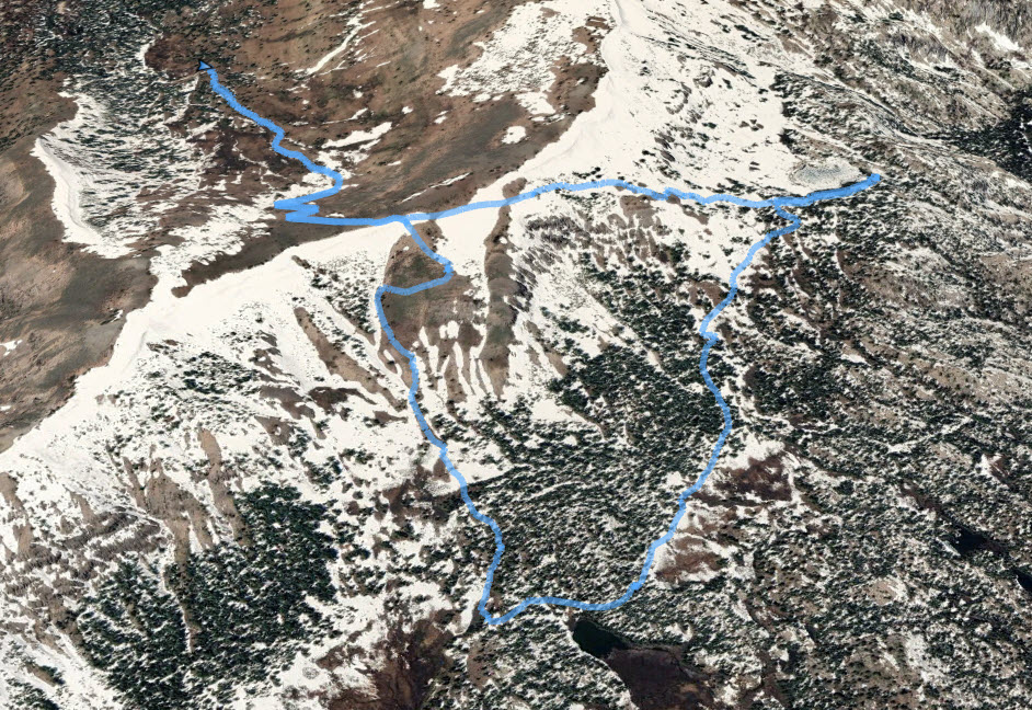
Distance: 6.0 Miles
Vertical Gain: 1800'
Group Size: 3
Hike Rating: Easy Moderate Hard Strenuous
 GPX
for
this trip
GPX
for
this trip 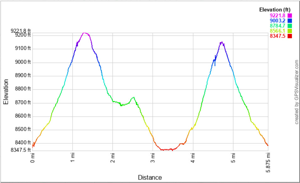
| Start Coordinates: | N 38 43.538, W 120 02.843 | End Coordinates: | Same as start coordinates | ||
| Car Shuttle Req'd: | Yes | Parking Directions: | Take Highway 88 to the turnoff to Schneider Cow Camp Rd on the north side of the road signed "Caples Lake Maintenance Station." Pass the Caltrans buildings on your right and turn right onto Strawberry Creek Rd. Continue on this rough, dirt road to the coordinates where there is parking for a few vehicles on your left. | ||
| Hazards of Note: | Weather in this area can change quickly so be prepared for
various temperatures and rain. |
Crowd Factor: | Moderate. The section from the first crest down to the PCT will have no others on it, but the PCT
(and Tahoe Rim Trail) at the bottom of the hill up to Showers Lake is very popular with both day hikers and backpackers. |
||
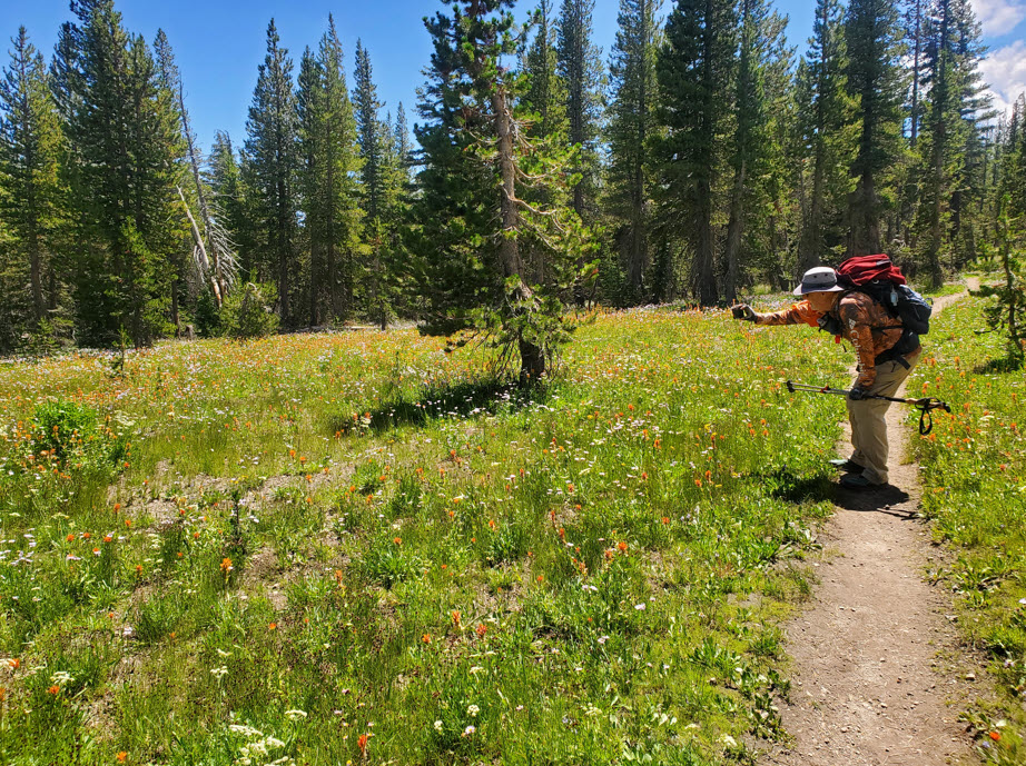
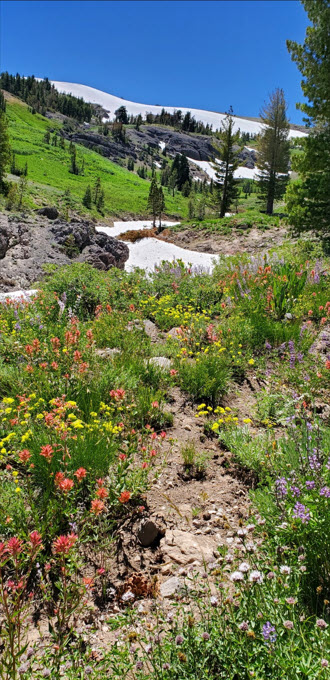
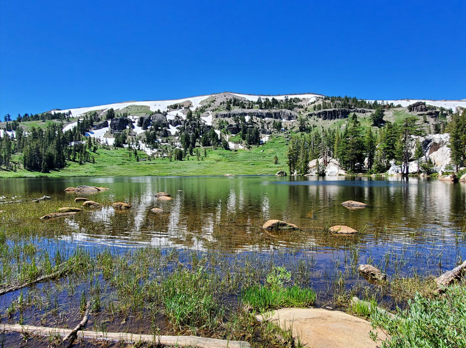
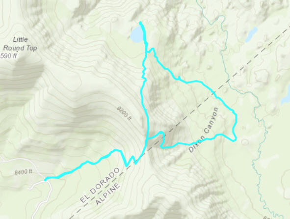
| General
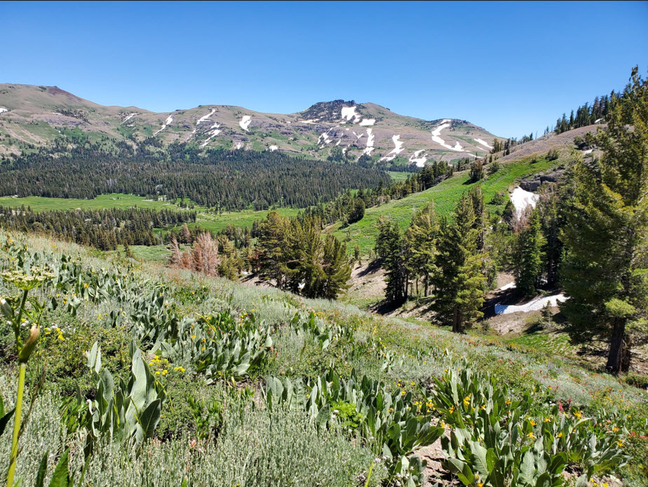
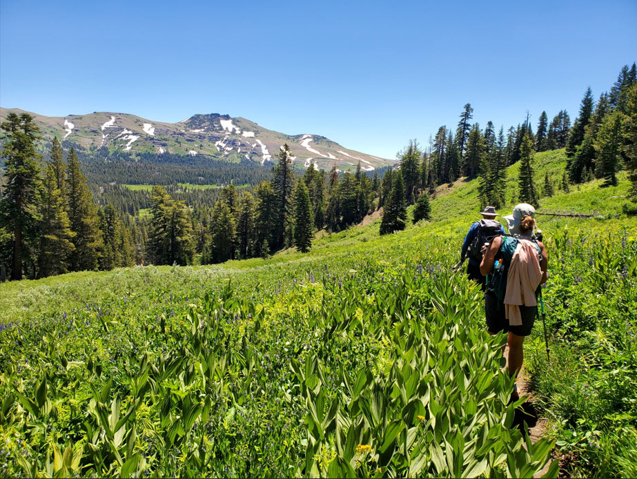
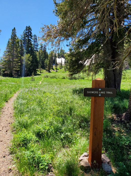
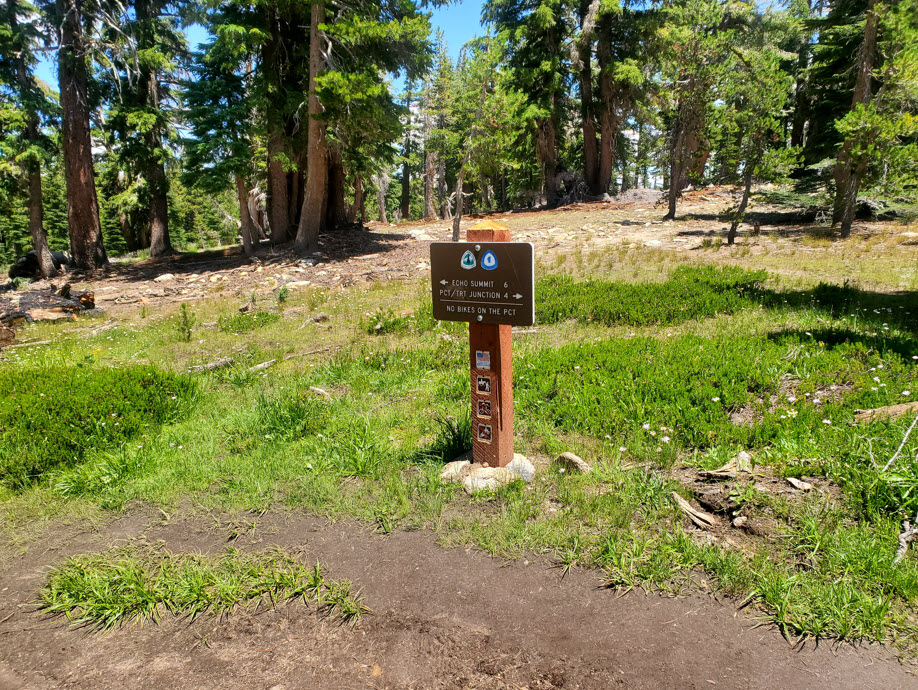
Notes: From the parking area continue up the road just a few hundred feet to find the trail headed to the east. Follow this trail through some early forested section, but it will quickly open up and begin a series of long switchbacks that will take you up the side of the hill to a gap almost 1000 feet above where you started from. At this point you have great views back behind you to Kirkwood and the Thunder Mountain area, as well as nice views of the Lake Valley below and even Lake Tahoe in the distance. Take the trail that heads northeast for about 300 feet and find a junction to the east to start the way down the Showers Lake Trail down into the Meiss Valley. Follow this meandering trail down to reach the PCT, and then head left (north) on the PCT. Follow the PCT for a couple of miles until you reach Showers Lake. There is a nice rest spot with campsites on the northeast side of the lake. Then, follow the eastern edge of the lake south to pick up the trail heading back up from the south side of the lake toward the initial crest you reached up out of the Schneider Cow Camp area. Once back at the junction down to Schneider Cow Camp, follow this trail back to finish the loop. |
|||||
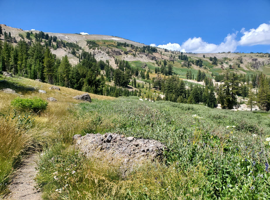
in the distance as well as a look down the trail back up to this spot from the PCT that will be traversed later on in the loop.
below at the west edge of Meiss Meadow. It is the preferable direction as the trail tends to be steep in spots.