
|
Twenty
Lakes Basin Hike
|
|
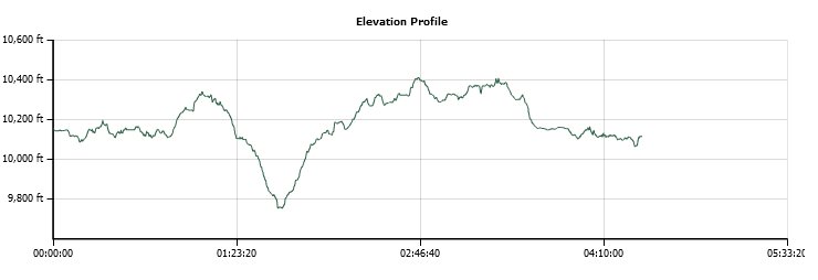
Trip Date: 07/16/2015
Distance: 10.3 Miles
Vertical Gain:
1200' (300' without Lundy Canyon tangent)
Group Size:
1
Hike Rating:
Easy
Moderate
Hard
Strenuous |

 GPX for
this trip
GPX for
this trip
|
|
|
Start Coordinates: |
N 37 57.872, W 119 16.325 |
|
End Coordinates: |
Same as Start Coordinates
|
| Car Shuttle
Req'd: |
No |
|
Parking
Directions: |
From Highway 395 turn west
toward the Yosemite park entrance on the eastern side of the park.
Follow Highway 120 (Tioga Pass Road) approximately 8 miles to
the turn onto Saddlebag Lake Road on your right. This road
heads north about 2.5 miles, mostly on dirt to the parking area just
before the Saddlebag Lake dam on the right. Park in this area
near the coordinates provided. |
| Hazards of
Note: |
Mosquitos, and the connector
trail between Lake Helen and Steelhead Lake is a use trail and can
potentially require trail finding skills. |
|
Crowd Factor: |
Moderate to Busy.
This is a very popular trail, especially with the
accessibility to the lakes area past Saddlebag Lake via the boat
shuttle run by the resort at Saddlebag Lake. |
General Notes:
If
not electing to take the boat shuttle across Saddlebag Lake to the
beginning of the Hoover Wilderness area, you will find the Saddlebag
Lake Loop trail sign just south of the resort area parking lot.
This loop travels counter-clockwise around the lake, and it
is about 2.5 miles along the eastern shore that you will travel before
coming to the signs indicating the Wilderness area and the two
directions you can choose from. Most people go clockwise from
here, due to the elevation gains early on, but I found going
counter-clockwise to be less crowded early on plus the views down
toward the upcoming lakes along this direction were amazing.
Three lakes will divert your attention over the first mile and a half,
as well as the towering features of Mt. Conness and North Peak on your
left as you head down the canyon. Just past Helen Lake there
is a sign to either head left to Steelhead Lake, or go right and down
into Lundy Canyon toward Lundy Lake. If you go about 1/2 mile
along this canyon route, you will be treated to fantastic views of
Mills Creek cascading out of Lake Helen and down over 1000' to the
bottom of the canyon below you.
Heading left toward Steelhead Lake you will pass by falls coming out of
Shamrock Lake, and then be treated to the granite rimmed Shamrock Lake
with its islands as you continue to the west. Steelhead Lake
is next, and you can either follow the existing trail down the eastern
side of the lake, or continue up toward the old mining area high above
the northwest end of the lake, and then follow use trails around the
western side of this lake into a lesser explored area of the 20 Lakes
Basin.
Eventually you will head south and come to Greenstone Lake, and there
is a rock crossing near a Hoover Wilderness sign that will allow you to
cross the water inlet for the lake without getting wet.
Assuming you keep your balance.
Follow the trail another mile around the western side of Saddlebag Lake
to finish up by crossing over the dam and returning to the parking area.
|
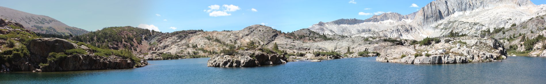
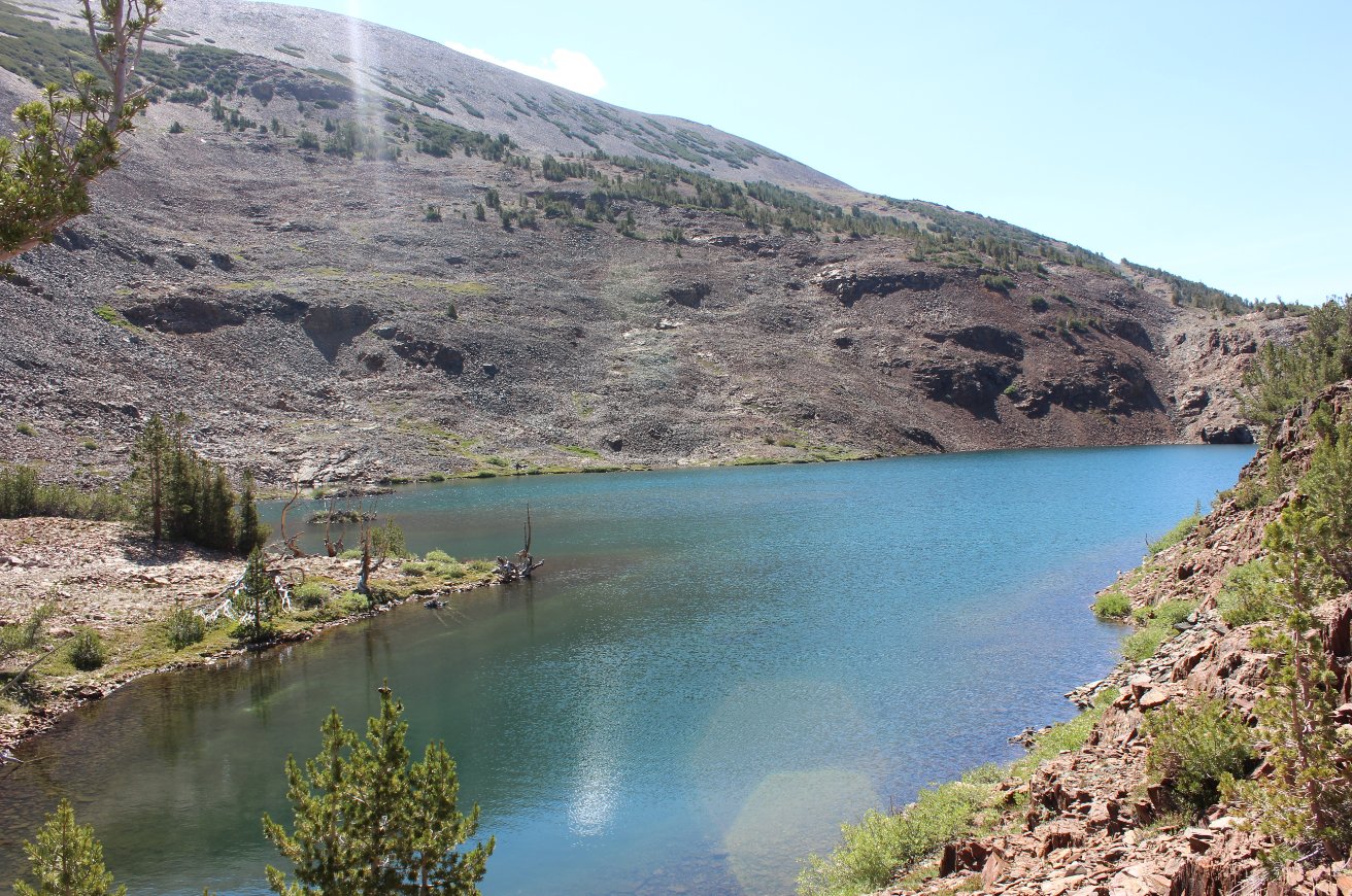
Panorama of Shamrock Lake from
the north shore
|
|
The parking area sign that you
will look for. Turn right into the parking area just past
this. |
 |
|
The first glimpse of Saddlebag
Lake, and the dam in the foreground which you will cross on the way
back from the complete lake circle loop.
|
 |
|
If choosing to do the boat
taxi to eliminate about 3 miles from the round trip hike, this is the
resort location where you will sign up for the service. |
 |
|
Just a little bit past the
store is the offical trail start, indicated by this sign for the
Saddlebag Lake loop. |
 |
|
The first views into the
Hoover Wilderness are pretty amazing, and it just gets better and
better along the way.
|

 |
|
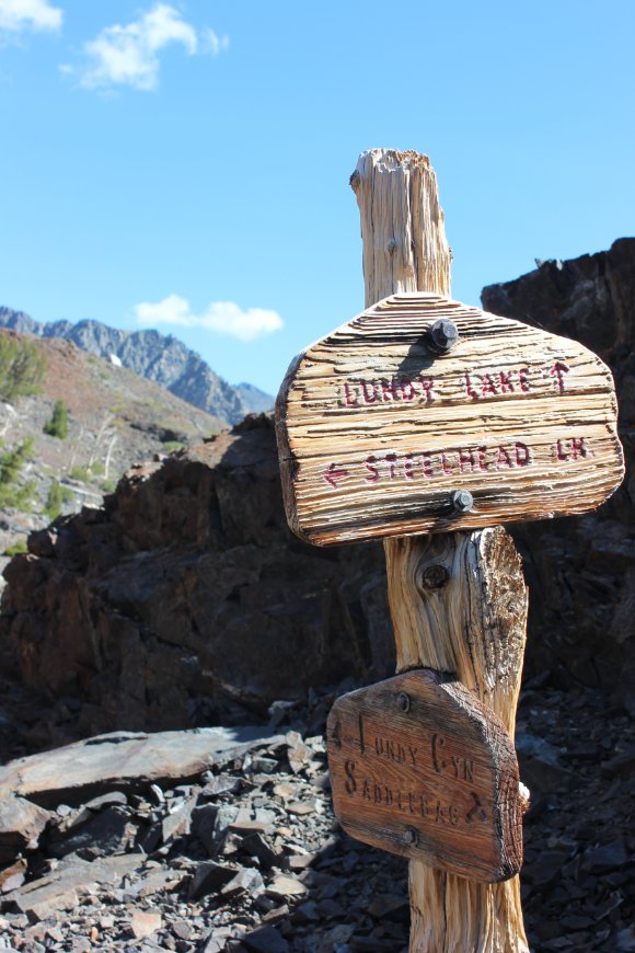
At the north end of Saddlebag
Lake, just about 500 feet from the boat dock you will come across these
signs. Your choices are which way to loop around the Basin
area, and I chose to head toward Lundy Pass to avoid the way most of
those departing from the boat were headed. |
  |
|
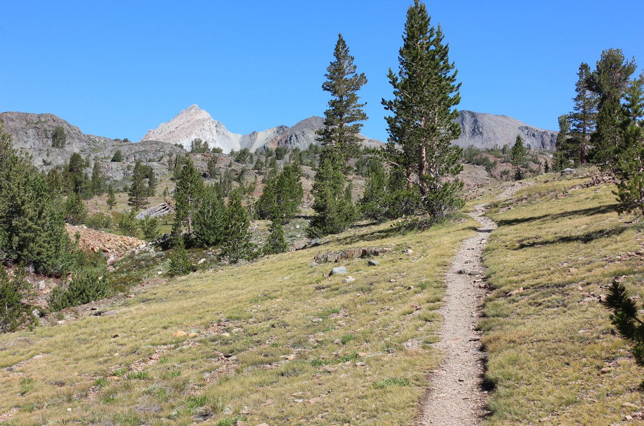
Heading up toward the first
wilderness lake, and seeing the start of many of the sharp granite
peaks to the west that will dominate much of this hike.
|
 |
|
Looking up toward Mt. Conness
to the west, and the ever-shrinking glaciers that used to dominate the
base of this mountain, even 10 years ago. |
 |
|
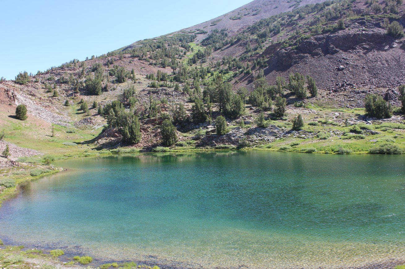
The first, very colorful lake
that the trail comes across is Hummingbird Lake. The blue and
green hues set against the gray and reddish rock is amazing. |
  |
|
Next up is Odell Lake, which
the trail skirts around on the western side. There were some
fishermen on the opposite side who were working hard but didn't seem to
have had any luck as of yet on the day. |

 |
|
The trail soon drops down into
the area where Helen Lake sits, which is actually the highest point of
one of the amazing waterfalls cascading down into Lundy Canyon. |

 |
|
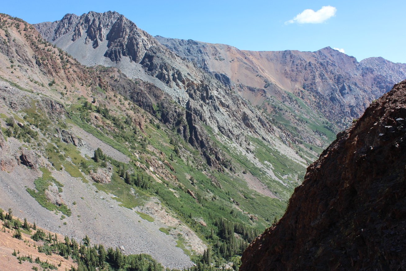
Before heading down into Lundy
Canyon a bit, this is the view across Lake Helen at North Peak. |
 |
|
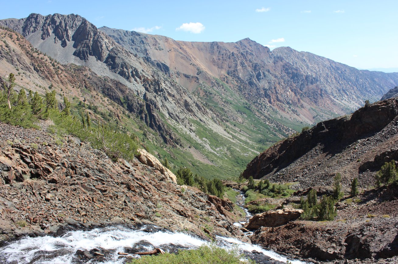
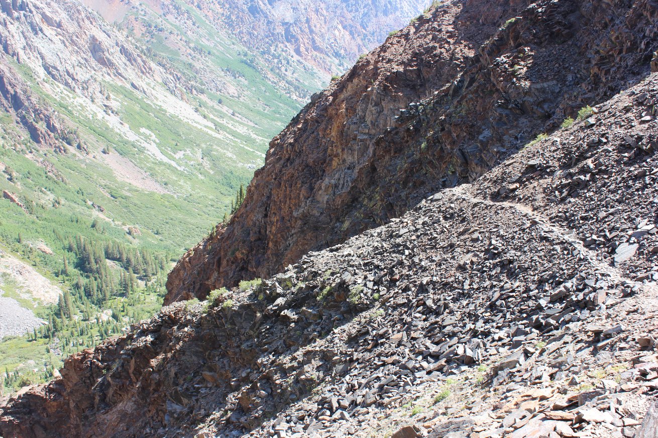
This is a pretty impressive
drop down into Lundy Canyon from here, over 1500' and there are at
least six water cascades lining the rim of the canyon which can be
spotted along that trail. |
 |
|
Not very well used, this trail
has some pretty tenuous sections, such as this slippery part along
loose rock and talus. Miners from the ghost town of
Bennettville actually pulled equipment up this way before laying the
groundwork for the Tioga Pass road. |
 |
|
Heading down the trail a ways
is worth it, with these views of the falls coming out of Helen Lake. |

 |
|
The views down into Lundy
Canyon weren't particularly bad, either. |
 |
|
Back up to the top there were
some nice views above Shamrock Lake of North Peak, and I even managed
to get a close up of the Conness Glacier remnants. |
 |
|
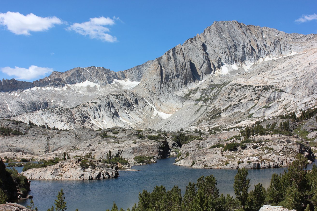
The view of Shamrock Lake from
the western side was very impressive. |
 |
|
Most people drop down and take
the trail along the far side of the lake back toward Saddlebag, but I
elected to head up to the mining area above the lake and continue cross
country and on use trails into the Hall Research Area. |
 |
|
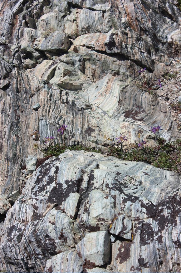
Along the backside of
Steelhead Lake were some pretty amazing rock strata formations that
caught my interest. |
  |
|
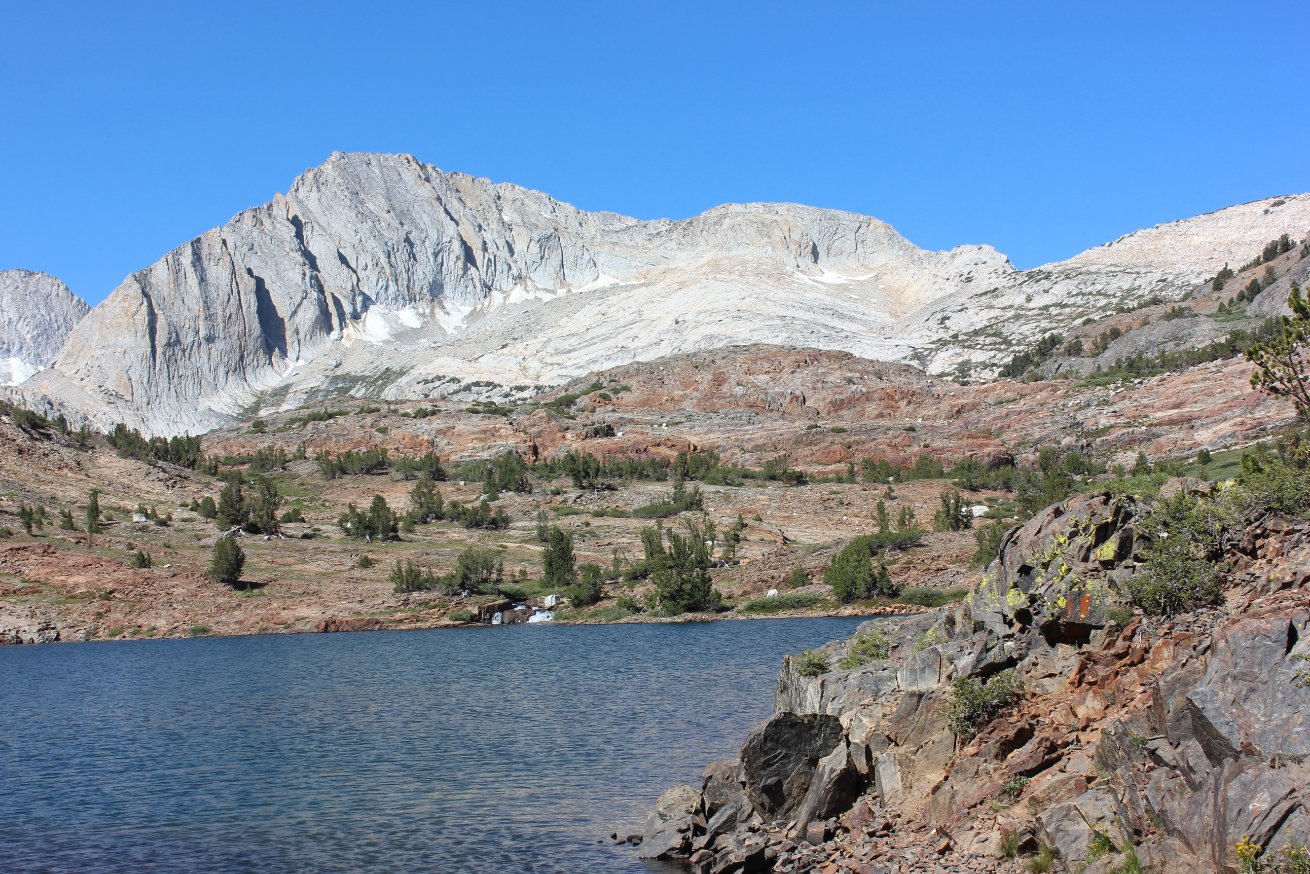
Cascade Lake sits right near
the base of North Peak, and is at the northern end of the Hall Research
Area. |
 |
|
This is undoubtedly one of the
sources of water which flows into Cascade Lake from far above. |
 |
|
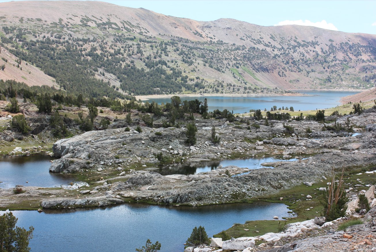
After
finding a path around the lakes near Cascade Lake, I was able to head
toward Greenstone Lake (far to the right) and past a few other lakes
whose names I did not know. |
 |
|
Greenstone
Lake presented one last hurdle, as there is no real way around, but a
way across (on rocks) soon was discovered off to the right of this
picture. |
 |
|
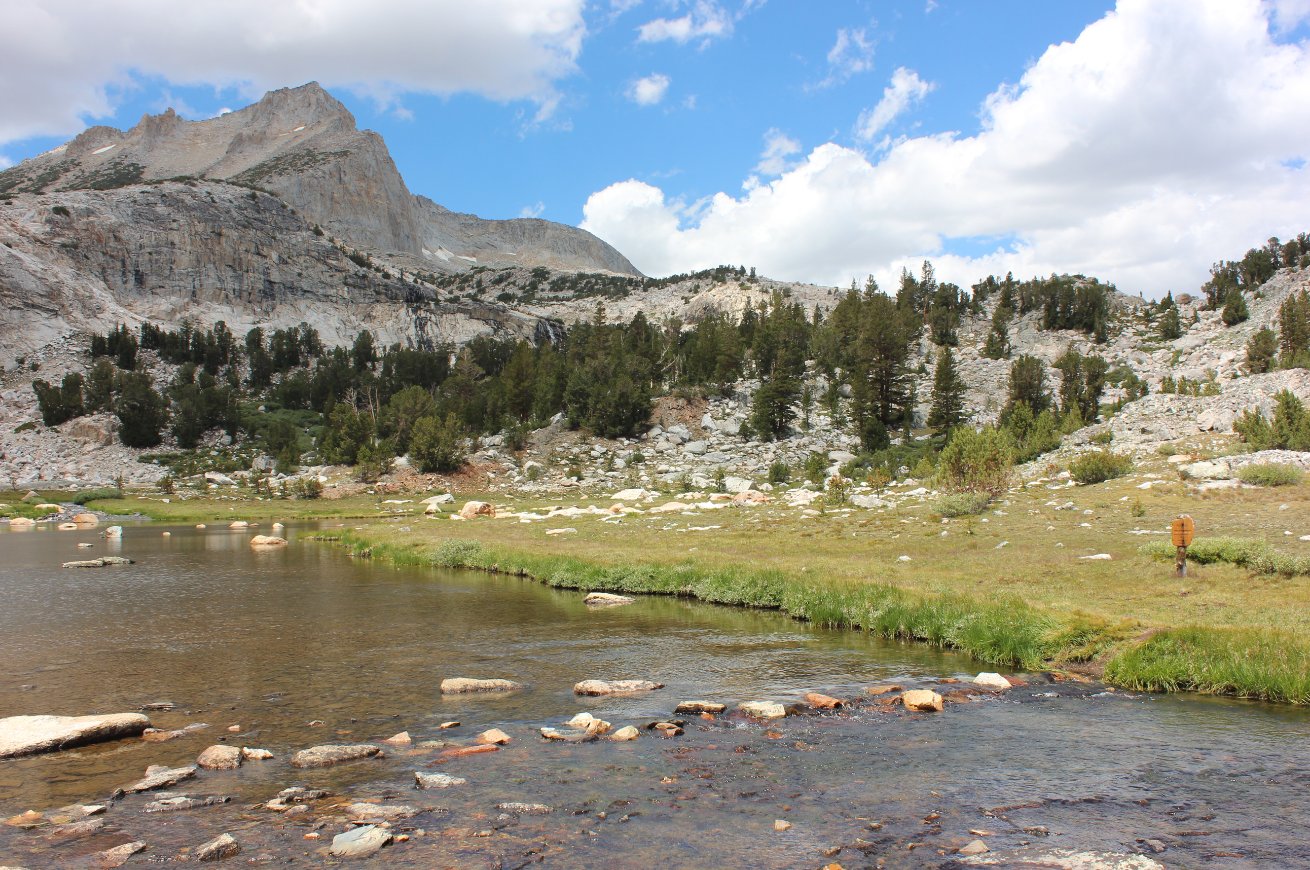
This
appears to be the offical way across Greenstone Lake's inlet as there
is a wilderness sign just on the opposite side of the water.
Interesting! |
 |
|
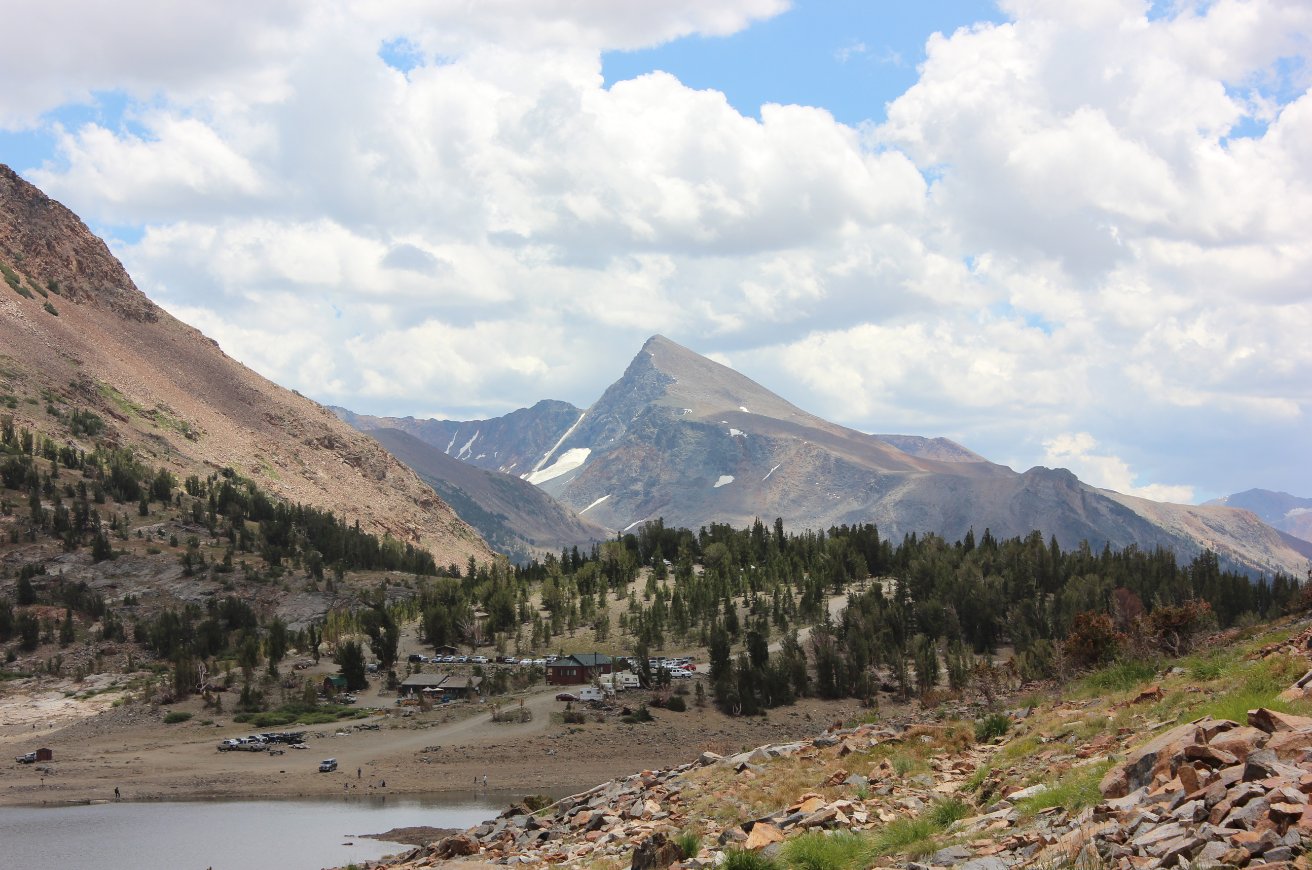
Almost
back to the end of the trail there is a great view of Mount Dana in the
distance, the second highest peak in Yosemite (and the destination for
my next day's hike.) |
 |
|
GPS Track of the full hike. |
 |