Back to index Truckee Falls Hike
Trip Date:  07/23/2016

Distance
: 3.0 Miles

Vertical Gain: 800'

Group Size: 7

Hike Rating:  Easy   Moderate    Hard    Strenuous
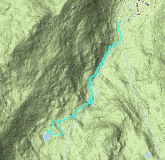
Truckee Falls Route
Download GPXGPX for this trip
Truckee Falls Elevation Profile
Start Coordinates:   N 38 47.638, W 120 01.258     End Coordinates:   Same as Start Coordinates
Car Shuttle Req'd:   Yes Parking Directions:   Take Highway 50 to S. Upper Truckee Road.  Turn south and head down approximately 3.6 miles to the entrace to the Hawley Grade National Recreation trail.  If the gate is closed, then park off the road in this area.  Otherwise, continue up the road for 1/10 of a mile to the parking area at the coordinates listed.  The end parking coordinates are at the parking area for Mt. Ralston, across from Camp Sacramento on the north side of the highway.
Hazards of Note:   Most of this trail is a non-official use trail.  Route finding is necessary a couple of times and there are steep sections of trail. Crowd Factor:   Moderate.  Although this is almost completely along a use trail, it is a well-known hike in the area and a popular outing for hiking, running and dog walking with local residents.
General Notes:
From the start parking area, follow the road south for a short distance past the sign for the Hawley Grade National Recreation Trail which heads off to the right.  Almost immediately the trail becomes a narrow, single-track use trail which begins to climb steeply as it passes a number of waterfalls to the east.  There are a number of places to head off the main trail to check out the various waterfalls closer, and evnetually the trail cuts up and away from the Truckee River, and a little bit of cross country navigation is required to reach a small, unnamed lake which is less than a 1/2 mile north of the larger Elbert Lake.  


Fall colors on the S Upper Truckee Road near the parking area make this a great addition to this hike during this time of year.   Fall color
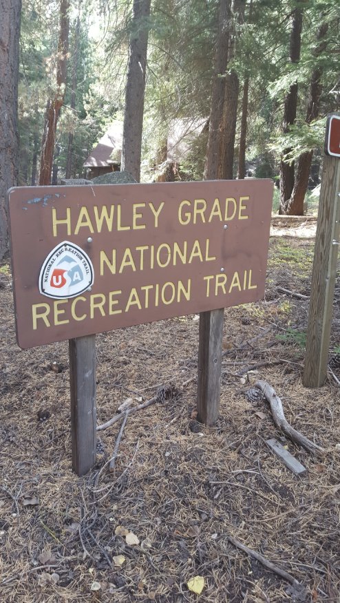
The sign for the parking area you are looking for, which is just past a gate that might be closed.  In this case, park just to the side on the road near the gate. Start of the hike 
The trail at the start is along a road headed toward the Hawley Grade trail which climbs the ridge up to Echo Summit. Heading out 
One of the early waterfalls before the trail begins to make a significant incline. An early falls
The group waiting for me to verify where the use trail headed off to at one point. Scouting the trail 
A second small falls with an enormous sentinel rock watching over it. Second Falls
A few obsticals line the trail along the way, but nothing stalwart adventurers can't handle. Unmaintained
There are some steep sections which require very non-technical rock climbing. Trail getting steeper
The good part of a steep climb along a river is it will make for some great waterfall opportunities along the way. More falls
Three of us decided to keep going past a second steep spot, along with the navigation dogs. Navigating the trail
Pushing ahead was worth it, as we soon were presented with the best one of the bunch! Tallest falls     
Although it took a little scrambling at the end, the unnamed lake we got to was very peaceful, and the dogs enjoyed the cool water. At the lake At the lake
Looking south from the lake you can just see part of the area that the Pacific Crest Trail heads over (to the right of the peak) in its journey south of Echo Summit. PCT Area
GPX image of the hike. GPS track of hike