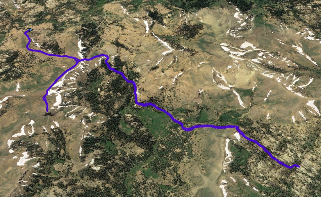
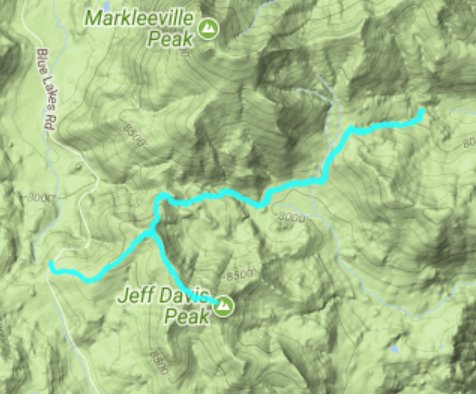
Back to index Thornburg Canyon (West) & Jeff Davis Hike

Trip Date:  07/28/2017

Distance
: 8.25 Miles

Vertical Gain: 1000'

Group Size: 2

Hike Rating:  Easy   Moderate    Hard    Strenuous
Thornburg Canyon Route
Download GPXGPX for this trip

Thornburg Canyon West Profile
Start Coordinates:   N 38 38.427
W 119 54.957
    End Coordinates:   Same as Start Coordinates  
Car Shuttle Req'd:   No
Parking Directions:   Take Highway 88 to the Blue Lakes Road turn south, just to the west of Pickett's Junction.  Go south on Blue Lakes road 10 miles to the parking area listed at the GPS coordinates.  There is a small pull-out on the west side of the road that can accomodate 4-5 vehicles at this location.
Hazards of Note:   Route-finding skills necessary.  Do not attempt without orientation experience and good navigational skills.  This hike has been rated as "Hard" rather than "Moderate" due to this factor.

Crowd Factor:   None.  The Thornburg Canyon trail has not been maintained to any degree in more than a decade, and while listed in a number of publications, they mostly describe the hike coming from the east near Markleeville.  The only person encountered on the day we hiked it was on his way to Jeff Davis Peak along the use/social trail we took near the end of the journey.
General 
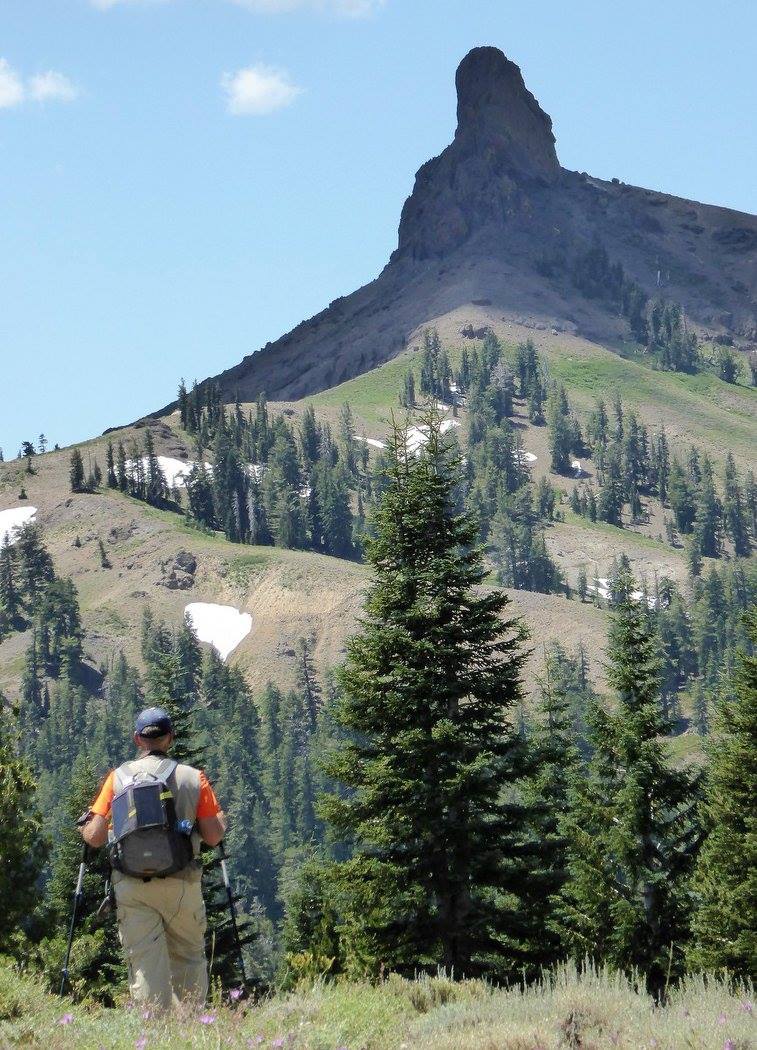
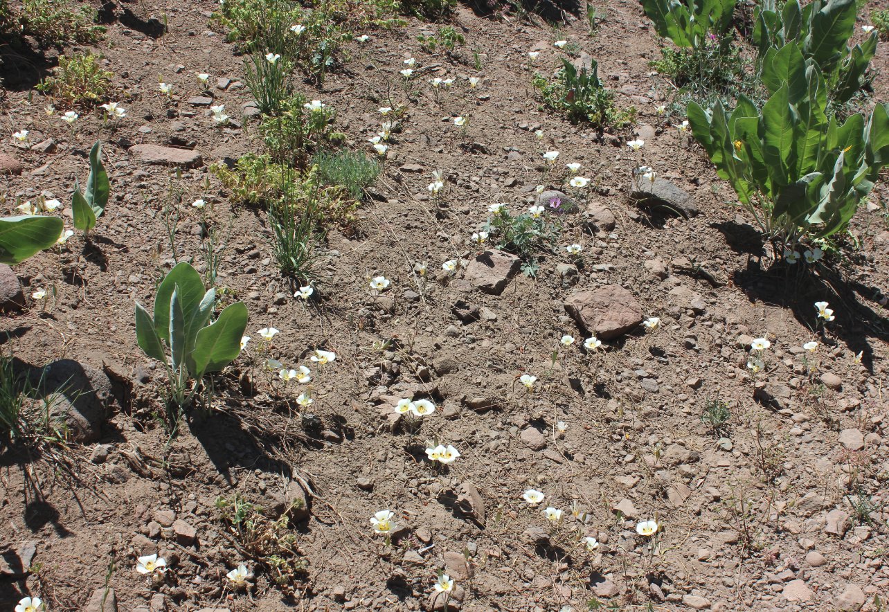
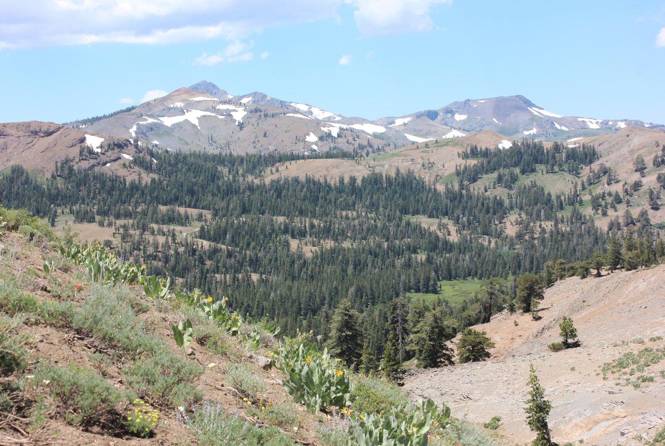
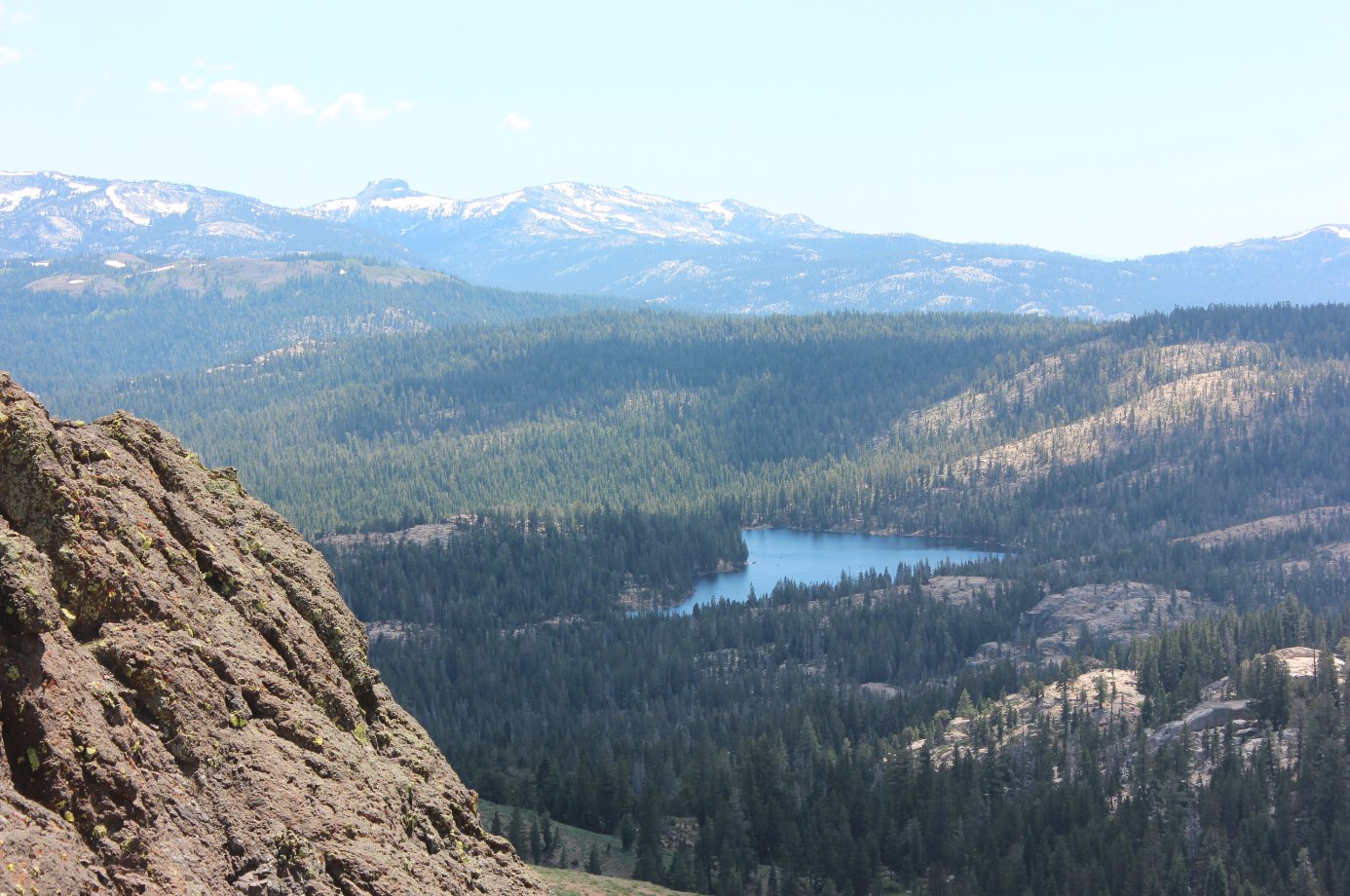
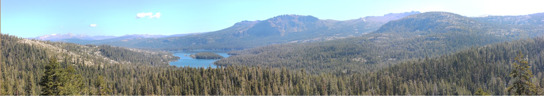
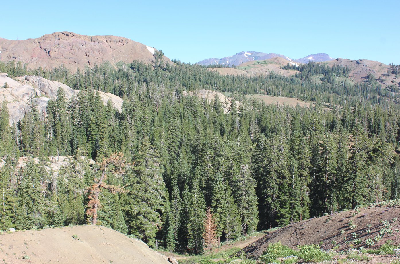
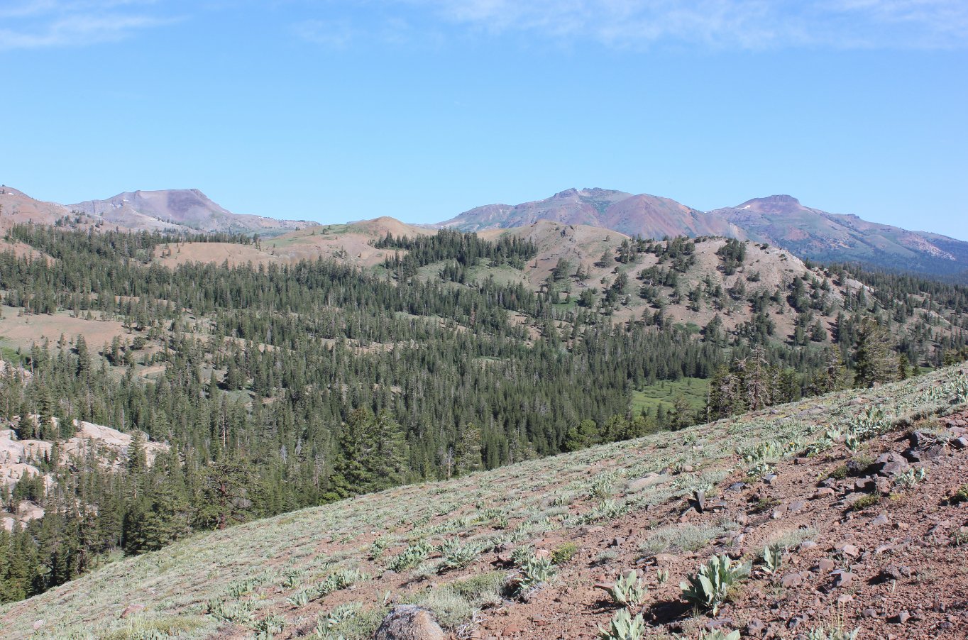
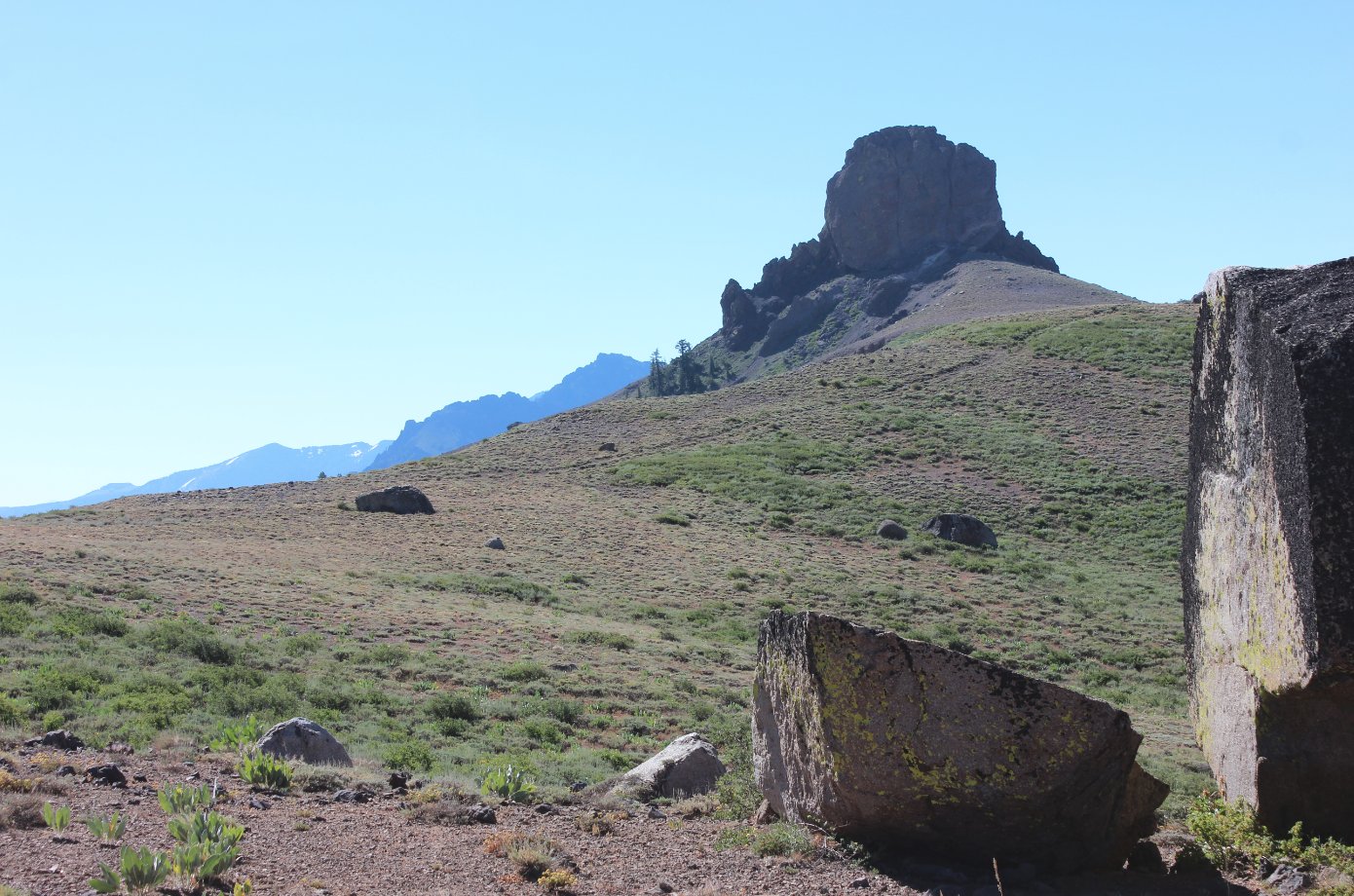
Notes:
From the parking area, carefully walk across Blue Lakes road to the trailhead which begins between two large rocks on that side of the road.  There was a "no snowmobiles" sign which was down on the ground behind these rocks, and about 100 feet up the trail is a 4x4" post which has been broken off about 10 inches up which probably used to have a sign of some type.  Follow this obvious trail (and undoubtedly former jeep trail given the dual track nature of the path) up to an early crest with fantastic views of the Blue Lakes mountain area to your west.  You will also see Jeff Davis dominating your view to the east, as well as Raymond, Reynolds and other peaks far beyond.  
At this point the trail will bend to the north, toward Markleeville Peak for a short time before it bends back to the east and drops down into the beginning of the canyon.  There is another rise in less than a mile with more fantastic views all around, especially back behind from the way you came.  Once you reach this second rise the trail really becomes spotty and often difficult to follow, with some areas requiring GPS tracks or luck to continue on along the actual intended trail.  There were a significant number of trees down on the trail, some of which had use trails winding around them, indicating that there has been some visitation along this trail from time to time.  
After about 3 miles the trail begins to drop down into the canyon in earnest, with rock cairns (ducks) often marking the path.  After four miles there is a rocky overlook of the continuation of the trail with a clear view of Thornburg Peak to the Southeast.  This was where we decided to turn around and navigate back toward Blue Lakes road, deciding to visit Jeff Davis Peak on the return.
The use/social trail from the Thornburg Canyon trail toward Jeff Davis to the south is obvious at about 3/4 of a mile from the start.  Follow this trail across open area filled with incredible displays of wildflowers in the summer, especially through the largest display of Mariposa Lillies I have come across to this point.  After the trail climbs a couple of rises it veers directly to the east toward the base of the basalt plug that is the true peak of Jeff Davis.


The location of the parking area (small arrow) and the location of the start of the trail as shown on Google Earth.
Parking area

Even before the hike starts the views to the west and northwest are pretty fantastic.  This is from the back of the car while putting on hiking boots.  In the distance are Red Lake and Stephen's Peaks which are just north of Highway 88.
Looking west from the parking spot 

Elevation gain comes quickly right from the start, but the amazing display of wildflowers all around just adds to the picturesque nature of the walk.
Quick elevation from the road 

These scarlet gilia were some of the color along the early section of trail.
Gilia 

Behind us the Nipple dominated the view and Round Top could even be spotted further into the distance behind it.
The Nipple 

Mule Ears, Lupine, Gilia, Mariposa Lillies in the foreground all did their best to distract from the mountain views to the south.
Looking south

Partially visible for most of the start, at about a mile in Jeff Davis Peak quickly dominates the view to the east.  Raymond Peak is just visible behind it.
Jeff Davis 

One of the more impressive flowers spotted frequently on this trail is the Columbine.  
Columbine

We had been told to keep a close eye out for wildlife on this trail, and though we spotted a good amount of (dry) bear scat, this Garter Snake was the only animal which visible crossed our path on the day.
 Wildlife

One of the areas along the Jeff Davis Creek where the underlying granite has been exposed by erosion.  Along parts of the creek the bottom almost looked like a porcelain bathtub.
Looking north

Raymond Peak to the south of the trail with just a glimpse of Reynolds Peak behind it.
Raymond Peak

Yours truly checking out a very different view of Jeff Davis Peak looking back at it to the west.  It is much more imposing a sight from this angle.
Jeff Davis

As we neared our turnaround point four miles east of Blue Lakes Road, Thornburg Peak came into view further past where we were headed, as well as what appears to be a pretty direct route from the northwest which leads up to the top.
Thornburg Peak

There were two places along the way very near water crossings where we spotted some nice clusters of Monkeyflowers.
Monkeyflower

This was our view from some rocks further down into Thornburg Canyon from where we stopped to have lunch and then head back the way we came.  It would be another almost four miles of route-finding to get to the eastern trailhead for this canyon hike.
Lunch view

The Mariposa Lily must really like this area, because they were everywhere along the entire trek.
Mariposa Lillies

This particular area of Blue Flax was impressive.
Flax
Even though it was almost August on this hike we encountered a couple of blooming Snow Flowers which usually come out right after the spring snow melts.
Snow flower

From the trail, the views of Red Lake and Stephen's Peaks are pretty amazing.
Red Lake and Stephens

The approach to Jeff Davis peak from the west isn't particularly difficult, at least to the base.  After that, it's a vertical climb of at least 100' up rock that I wouldn't attempt, but many do.
Approaching Jeff Davis
From the base of Jeff Davis to the west is Meadow Lake, as well as Mokelumne Peak in the distance.
Meadow Lake
To the southwest is a good view of Tamarack Lake, as well as some of the mountain peaks which line the next highway (Hwy 4) south of this area, known as Ebbet's Pass.
Southwest
A look back west at the Nipple, with my hiking partner Mark in the foreground for reference as to how massive the mountains in this area really are.
The Nipple again

GPS Track of the full hike. GPS Track of Hike 
if