
|
TRT
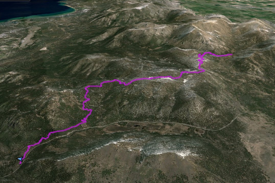
- Segment 5b - Armstrong Pass to Big Meadow
|
|
Trip Date: 07/14/2015
Distance: 10.4 Miles
Vertical Gain:
1300'
Group Size:
1
Hike Rating: Easy
Moderate
Hard
Strenuous |

 GPX for
this trip
GPX for
this trip
|
|
|
Start Coordinates: |
N 38 49.823, W 119 54.042 |
|
End Coordinates: |
N 38 47.367, W 120 00.017
|
| Car Shuttle
Req'd: |
Yes |
|
Parking
Directions: |
For parking at Armstrong Pass, make sure that you have a 4WD or high
clearance 2WD vehicle for Forest Road 51. Take Luther Pass
Road (Highway 89) to the turnoff onto Forest Road 51 exactly 1.8 miles
north of the junction of Highway 88 and Highway 89. Follow
this dirt road approximately 3.5 miles into the parking area at
Armstrong Pass.
For parking at Big Meadow at the end, take
Highway 89 south from Meyers (Hwy 50) or north from Pickett's Junction
(Hwy 88) to the parking area for the Big Meadow trailhead on South
Upper Truckee Road on the north side of the highway. Park in
the
paved parking area.
|
| Hazards of
Note: |
Bike riders moving very
quickly. A good climb the first mile and a half of over 1000'
of elevation. |
|
Crowd Factor: |
Moderate. This is a
mixed used trail popular mountain biking area so keep an eye
out for quickly approaching
bicyclists. |
General Notes:
From the parking area on Forest Road 51, head southwest and find the
bridge that you didn't just cross with your vehicle to get to the
actual trailhead for this point. You will climb a significant
bit over the first part of this hike, and after one mile you will come
to a signed junction where you will actually meet up with the Tahoe Rim
Trail. Follow the sign that points southwest to Big Meadow 9
miles away, and continue to climb through the forested trail as it
continues gradually but steadily up.
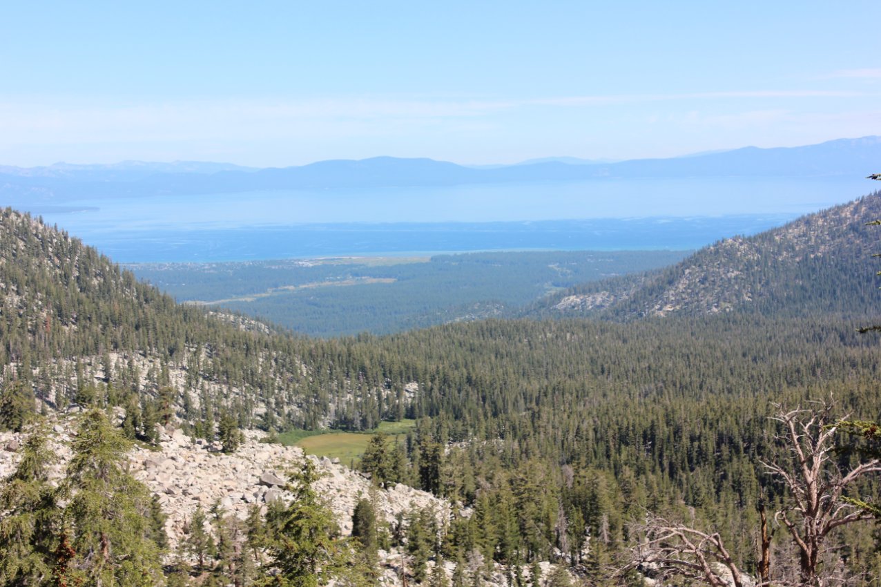
About 2 1/2 miles into the hike is where the views begin to open up,
including both great views of Hope Valley and the Central Sierra range
to the south, and at one point a glimpse through the trees of Lake
Tahoe a number of miles away from you at this point.
This section of trail tops out at about 9500' in elevation, and passes
near enough to the top of the ridge for the views that were hinted at
earlier really open up for unobstructed views both to the north and the
south. There are even nice views of Freel, Job's Sister and
Job's Peaks back from near the trailhead. Near the halfway
point the trail bends a little to the left, and there is a rocky
outcropping just about 100 feet off the trail to the right that is
worth paying a visit to. It provides a wonderful view of Lake
Tahoe along this segment, the best unobstructed view you will have the
entire time.
A little bit past this point you will pass by three pretty amazing
meadows, the first one a popular camping area for TRT thru hikers on
the left and then two additional ones further up on the right.
After you pass the last meadow and climb a little bit into
open area, be sure to look back and enjoy the views of the alpine trail
with the Carson Range of mountains far to the south.
As you continue along the trail and it begins to slowly start winding
down to the elevation of Big Meadow parking area at 7300' feet, you
will meet up with the Saxon Creek Trail which heads down to your right,
but you will stay on the trail heading west. There is one
more trail junction about a mile and a half from the end to meet up
with Highway 89 at Grass Lake, but you will just continue straight
until you reach a bridge and cross over to find yourself at the Big
Meadow parking area and the end of this section.
|
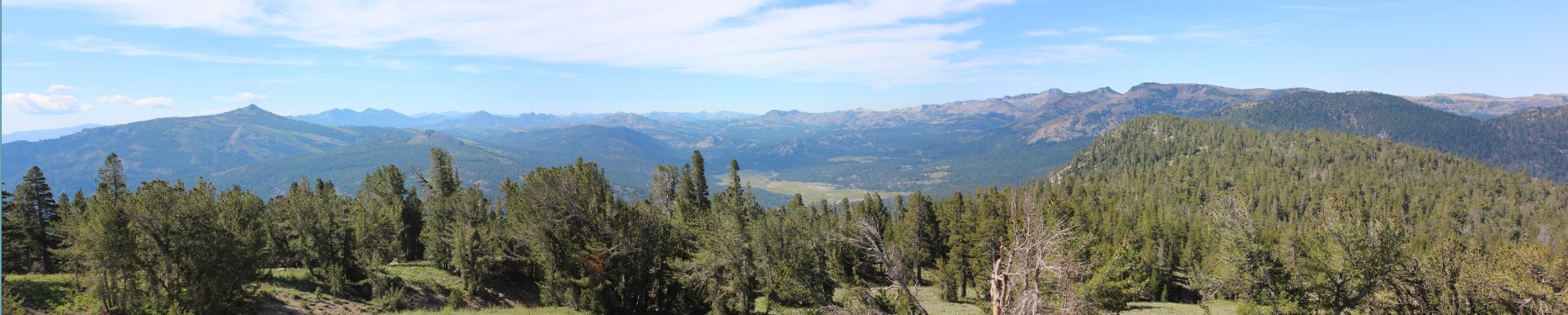
Hope Valley and Carson Pass
area panorama from halfway along this segment of the TRT
|
|
Due to the fact that this is
actually just about half of an 'official' TRT segment of nearly 25
miles, there is no standard TRT trailhead kiosk in this area.
However, the trail is easy to find, and almost immediately
starts a long journey upwards. |
 |
|
If you turn around during the
first half mile of the trail it is easy to see that you are gaining a
significant amount of elevation right away. Down in the trees
below is the parking area just off Forest Road 51 where this segment of
the TRT begins.
|
 |
|
After picking up the TRT
officially about a mile in, there was this specific switchback where
the sandy mountains that make of Freel and the more typical brownish
dirt for the South Tahoe Area literally changed from one step to the
next. |
 |
|
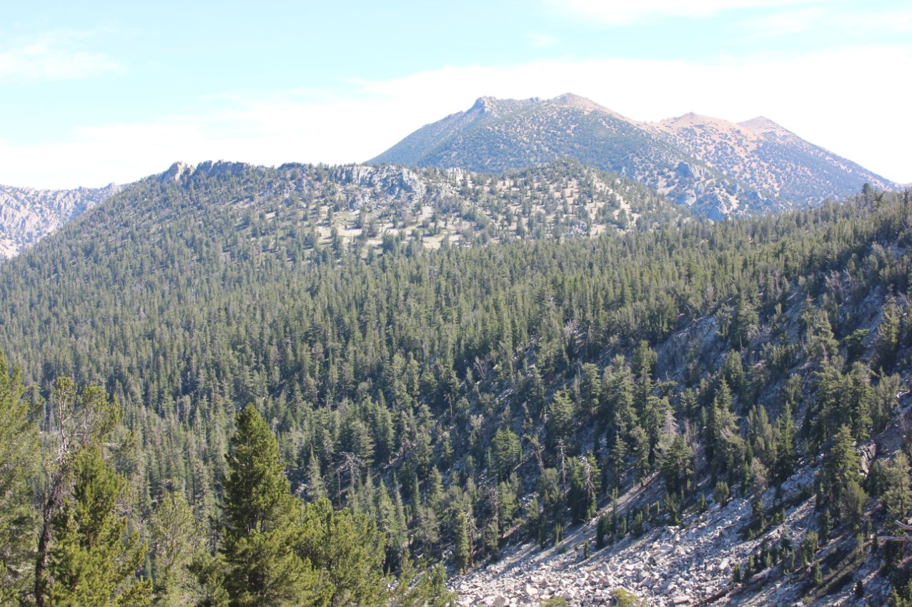
A little over two miles into
the trail the distinctive Hawkins Peak made it's first of many
appearances over the duration of this segment. |
 |
|
Lake Tahoe also made a quick
appearance by the third mile, but I wasn't sure if the trail would
offer any other views as it continued along the ridge.
Fortunately, it did! |
 |
|
Pretty soon the rocky Pickett
Peak made an appearance, as did Raymond Peak in the distance with its
neighboring jagged (and nameless) peak just to the west. |
 |
|
Soon a nice view of Hope
Valley showed itself, and the only way this could possibly be any
better might be in the fall when the colors in the area explode into
all different hues from yellow to orange to red. |
 |
|
Given the torrential downpour
and thunderstorm on the previous segment of hike a week earlier, it was
refreshing to look up and see little but blue sky and wispy clouds. |
 |
|
This helicopter circled Round
Top mountain to the south briefly before turning back north and heading
to Lake Tahoe airport. |
 |
|
Try as I might, I am pretty
much completely unable to look upon vistas like this and not flash back
to scenes from The Sound of Music. Awesome! |
 |
|
Just about halfway through
this section the trail hit the top of the ridge, and Freel Peak and
Job's sister made an appearance, looking far more inviting on a day
like this than on a day with thunder, lightning and hail. |
 |
|
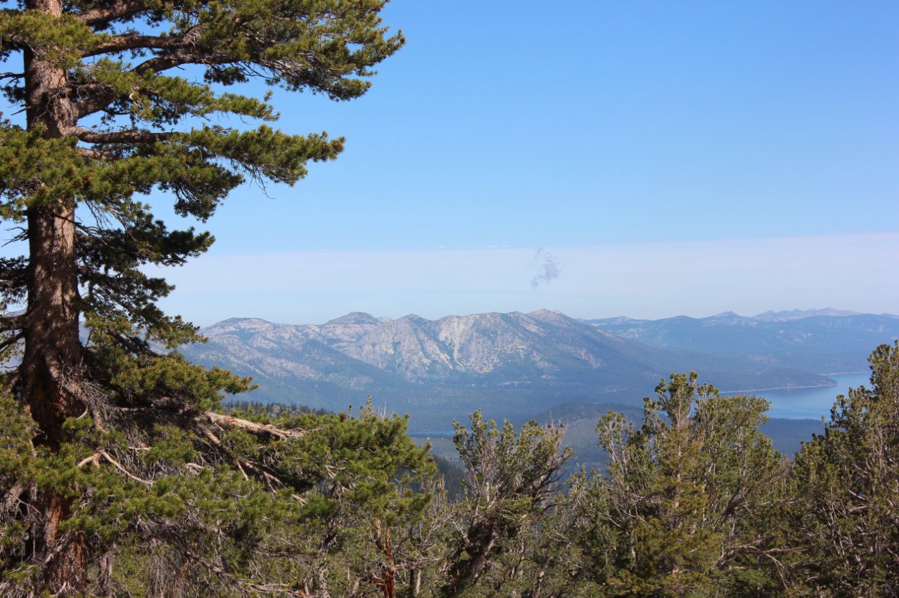
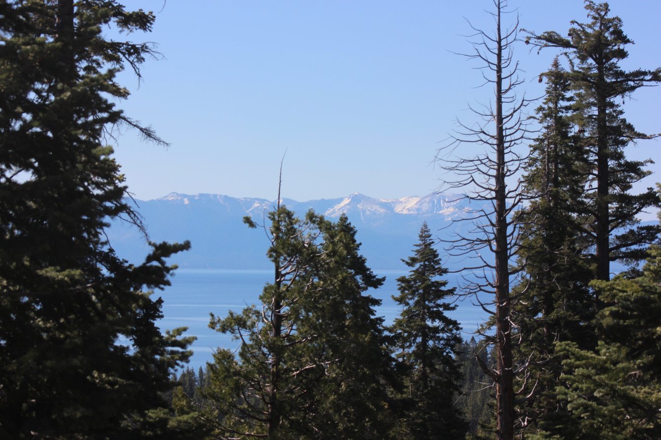
Early on during this trip Lake
Tahoe had made a brief appearance through the trees, but around mile
five there was a small rock cairn to the north of the trail which led
to this view all the way to the north end of the lake. Well
worth the short detour to get to this spot. |
 |
|
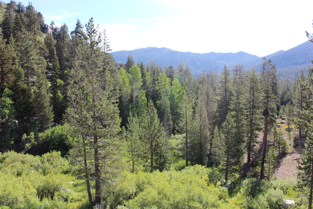
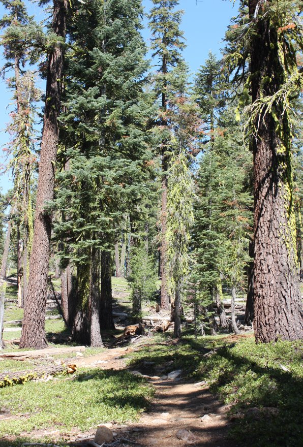
Continuing on from the
viewpoint, the trail returned to the trees, but then soon opened up
into a set of very impressive meadows. |
 |
|
The first meadow on the left
side of the trail still had water in the middle of it, and there were a
few TRT thru-hikers who were just breaking camp along the north edge as
I passed on by. |

 |
|
A second and third meadow
appeared soon after on the other (right) side of the trail, and the
wildflowers were in full display along this spot. |

 |
|
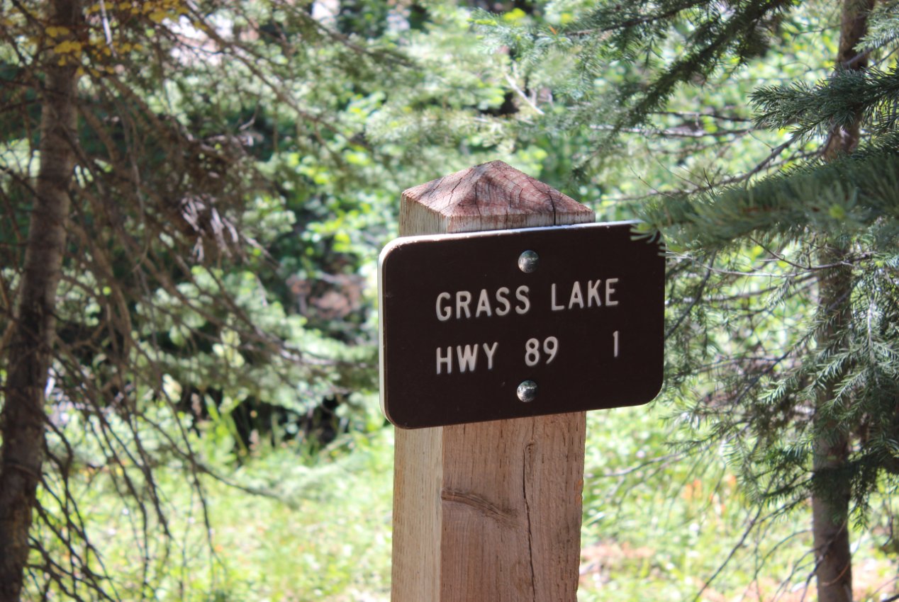
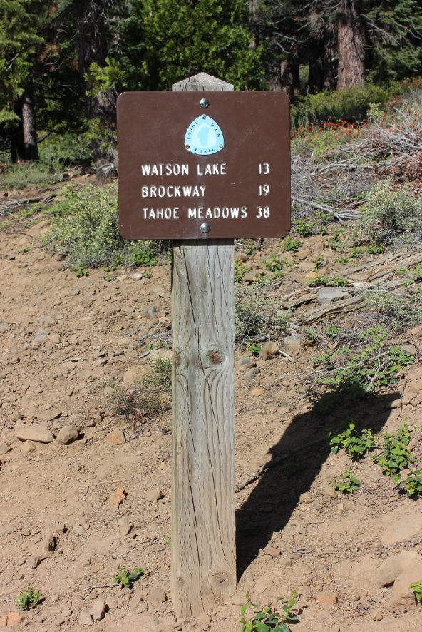
One noteable point about this
section of trail is that it was very rarely marked with any type of
signage. All of the other sections have been very regularly
reminding you of where you are at, but other than the first Big Meadow
9 miles away sign, this was the only sign anywhere between that and
about a mile and a half from the end. This marker indicates
the junction with the Saxon Creek trail, a very popular mountain biking
diversion. |
 |
|
A little further on the view
opened up directly to the west, and to the smooth peak of Little Round
Top on the other side of the cleverly named Lake Valley. The
next section of the TRT will actually travel from left to right just
below the peak, right were the gray granite ends and the brown peak
begins. |
 |
|
Just
about a mile and a half
from the end is the junction with the Grass Lake trailhead to the TRT,
which will cut off a little bit of the trail. Not exactly
certain
of the benefit of this spur, as it just dumps out along Highway 89 with
no parking (just a turnout.) |

 |
|
10 miles
from the start there is a nicely maintained bridge which escorts
travellers into the Big Meadow parking area. Hard to imagine
doing the entire 25 miles at one time, as it is a lot of miles through
pretty scenic country. |
 |
|
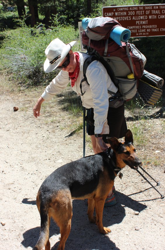
Just
about a mile from the end we met up with Liz and her dog Lucy, hikers
from North Lake Tahoe who were in the middle of a 5 day trip from
Kingsbury to Echo Summit. |
 |
|
No
segment hike would be completely without a visit to the ubiquitous
kiosk, with details on the particular segment and even some free maps
for those without. |
 |
|
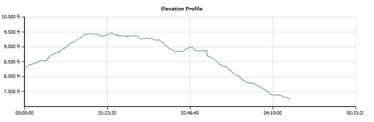
From right to left this gives
you an idea of the terrain and elevation for this particular segment of
the TRT. |
 |