
|
TRT
- Segment 2 - Brockway Summit to Tahoe Meadows
|
|
Trip Date: 06/30/2015
Distance: 22.1 Miles
Vertical Gain:
3200'
Group Size:
1
Hike Rating: Easy
Moderate
Hard
Strenuous |

 GPX for
this trip
GPX for
this trip
|
|
|
Start Coordinates: |
N 39 15.508, W 120 03.869 |
|
End Coordinates: |
N 39 18.777, W 119 53.853
|
| Car Shuttle
Req'd: |
Yes |
|
Parking
Directions: |
For the parking area on
Brockway Summit, take Highway 28 to Tahoe Vista, and then turn north on
Highway 267, North Shore Road. Follow this highway 2 3/4
miles to the parking area on the left (east) side of the road.
There is also a smaller parking area on the other side of the road, but
it may be difficult to see right away up a dirt trail about 200 yards
near the TRT kiosk.
For
the parking area for Tahoe Meadows, follow the Mt. Rose Highway (431)
north toward the Mt. Rose Summit and park at the large lot on the west
side of the highway. This is where you will end up at the end
if travelling this segment clockwise. |
| Hazards of
Note: |
The first 15 miles are a
constant uphill, with about 800 feet of elevation gain the last 3/4 of
a mile before Relay Peak. Much of the middle section is
unshaded. |
|
Crowd Factor: |
Moderate. The middle
section of this trail is in Mt. Rose Wilderness area and bicyclists are
not allowed along this stretch. |
General Notes:
From the parking at Brockway Summit the trail starts off at a TRT kiosk
and immediately starts the gradual climb from 7020' feet that will
eventually take you to Relay Peak, 15 miles away and at over 10,300' in
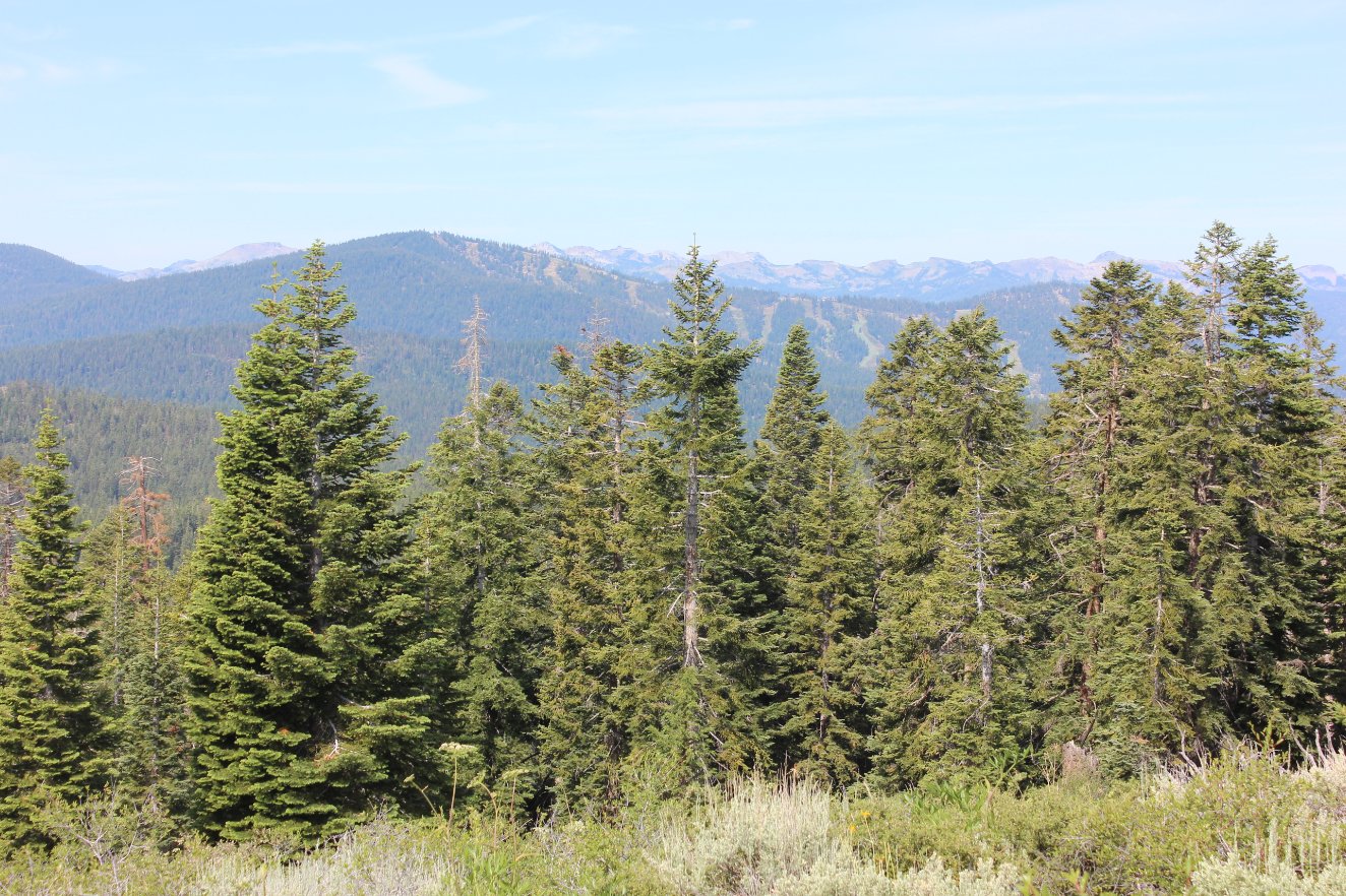
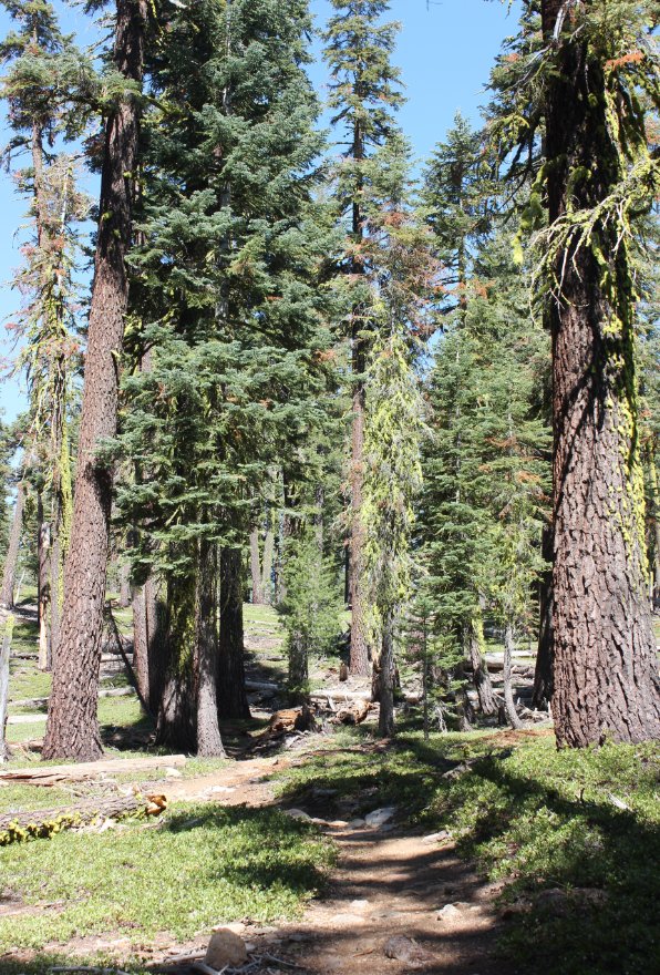
elevation. The first few miles are through forested area,
parallelling the Mardis Peak road on your left for much of this time,
at some points only a couple hundred feet away. Eventually
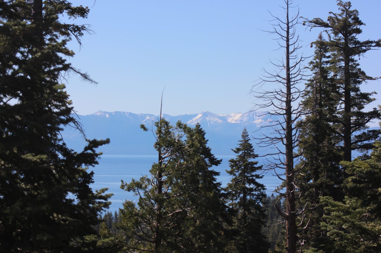
the trail starts to climb at a higher grade, and a few nice views of
Lake Tahoe to the south soon appear, as well as views to the west
toward Alpine Meadows and Squaw Valley now far in the distance.
There are three or four large meadows that you will walk
through, dominated by Mule Ear plants but including Indian Paintbrush,
Pansies and Lupine as well.
There is a section that takes you to the top of the current spine of
the mountain you are climbing which offers some nice views to the north
into Nevada, but then the trail turns back to the south and as you pass
into Nevada and the Mt. Rose Wilderness area, the forested area opens
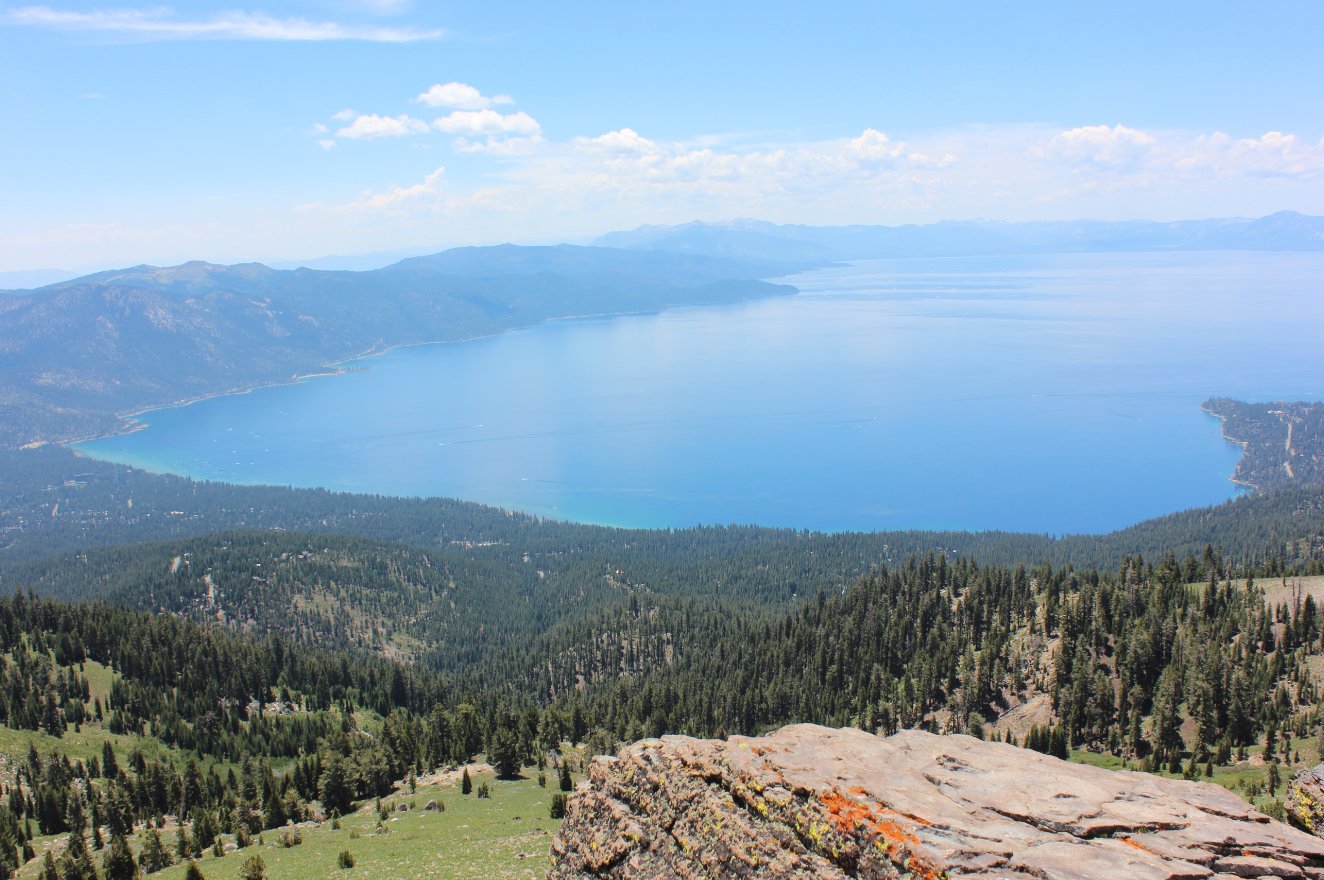
up to low brush and plants, offering spectacular vistas toward the lake
and toward Incline Village and the Nevada side of the lake as you
continue to climb to the east. Just south of Rifle Peak is a
small rocky outcropping that can climbed using a use trail just past it
that winds up around it to the northeast, with the payoff of an amazing
view of Crystal Bay 3000' below.
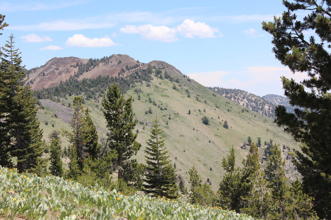
The trail continues to climb up and around Rose Knob, and then between
miles 14 and 15 the trail climbs another 800 feet via 6 long
switchbacks that are brutal and seem to never end. Once at
the top of Relay Peak, however, Mt. Houghton and Mt. Rose are in view,
and the communications tower offers two choices for continuing on the
TRT, one that is a mile shorter than the other. The shorter
section heads down to Frog Pond, where you can then turn north at the
TRT sign to head another 3/4 mile to reach the refreshing Galena Falls,
a year round water source fed by a natural springs. From here
it is 2 1/2 miles to the end at the Mt. Rose parking area and the
conclusion of the hike.
|
|
|
Looking back at the west side
parking area as you first head up the trail. There is parking
at the kiosk just a few hundred feet past this as well. |
 |
|
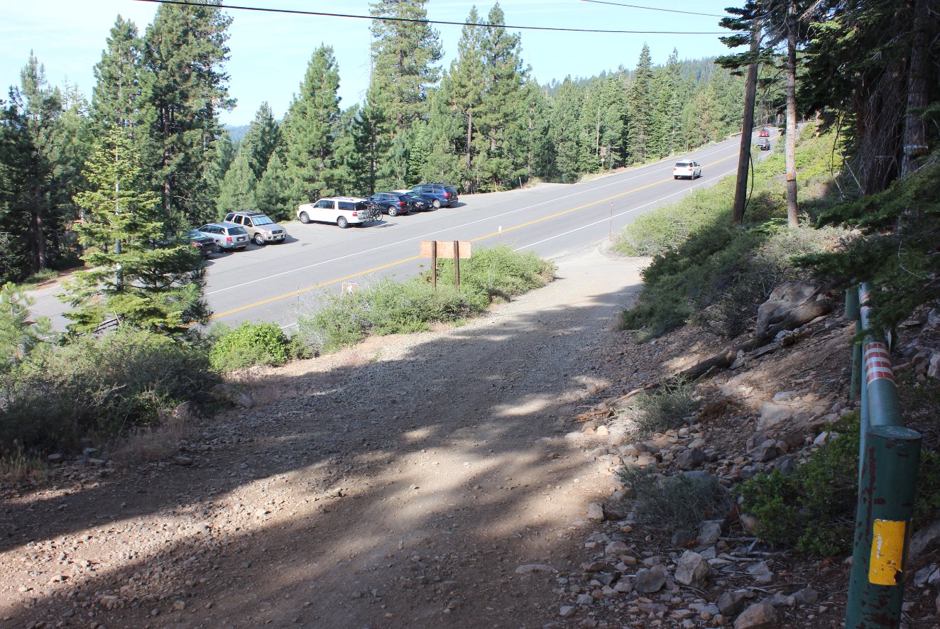
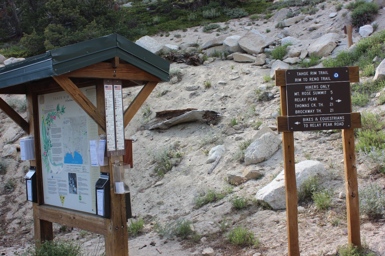
The official trail start for
this segment, with parking on dirt for a few cars just outside of this
picture and to the right.
|
 |
|
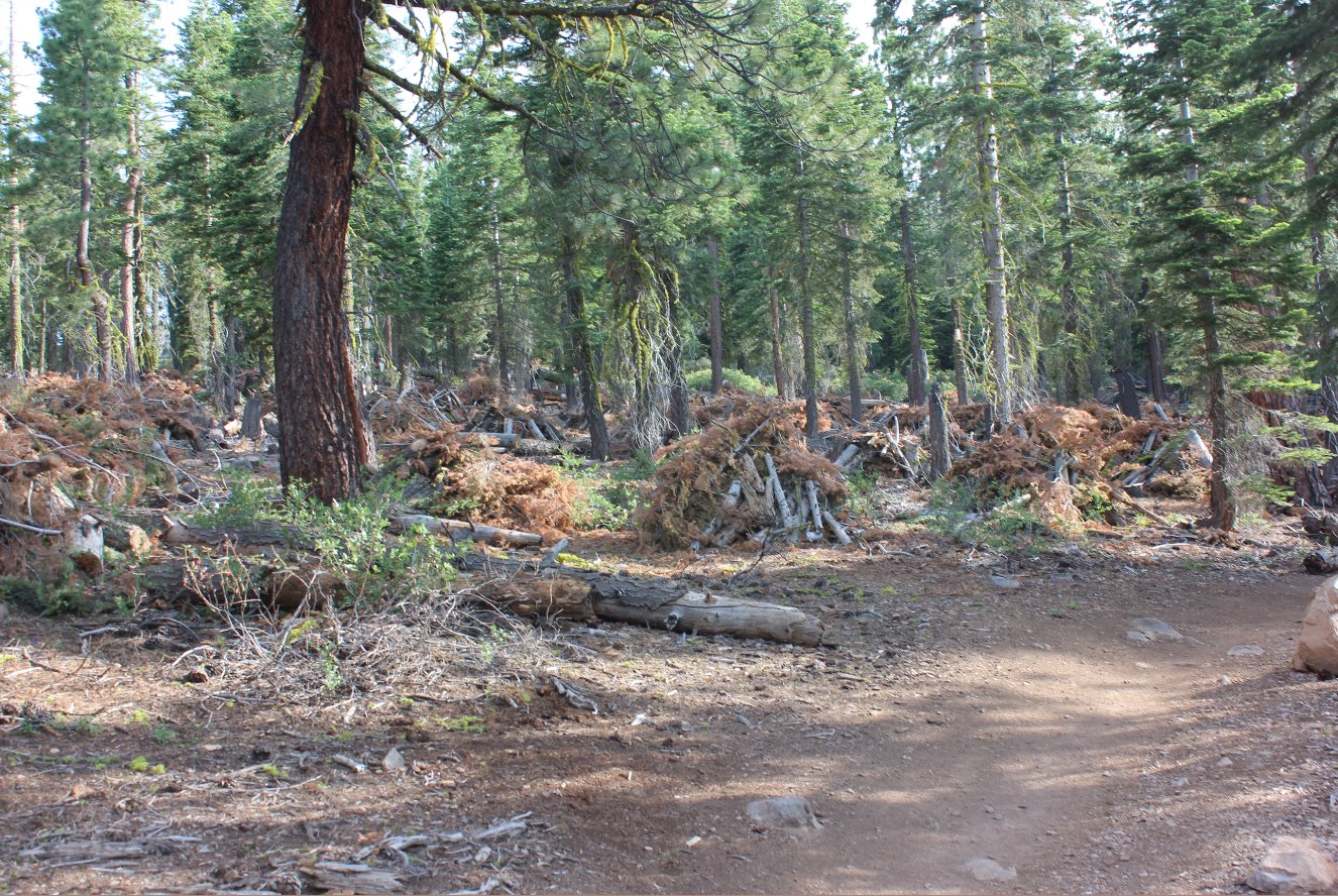
Lots of cleared brush along
the first mile of this trail. Lots of work has been done here
recently. |
 |
|
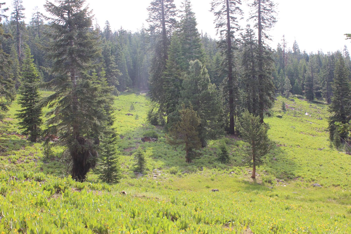
There are a number of pretty
amazing Mule Ear meadows the trail passes through over the first 3-4
miles. |

 |
|
At one point past the meadows
the trail popped up just high enough to see Alpine Meadows ski area to
the west, as well as the Donner Range which the Pacific Crest Trail
passes along the top of. |
 |
|
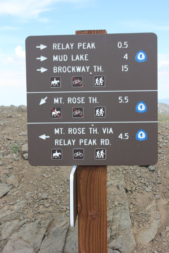
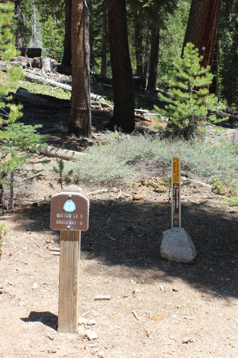
Most of the signs on the trip
are pretty straightforward, but this section has some really
interesting ones. This one required paying attention to so as
to not get off on the wrong trail. |
 |
|
Just before crossing into
Nevada, the trail offered some nice vistas to the north, toward Truckee
and the area east of there. |
 |
|
The last view of California
and Agate Bay before the trail crosses over into Nevada and the Mt.
Rose Wilderness area. |

 |
|
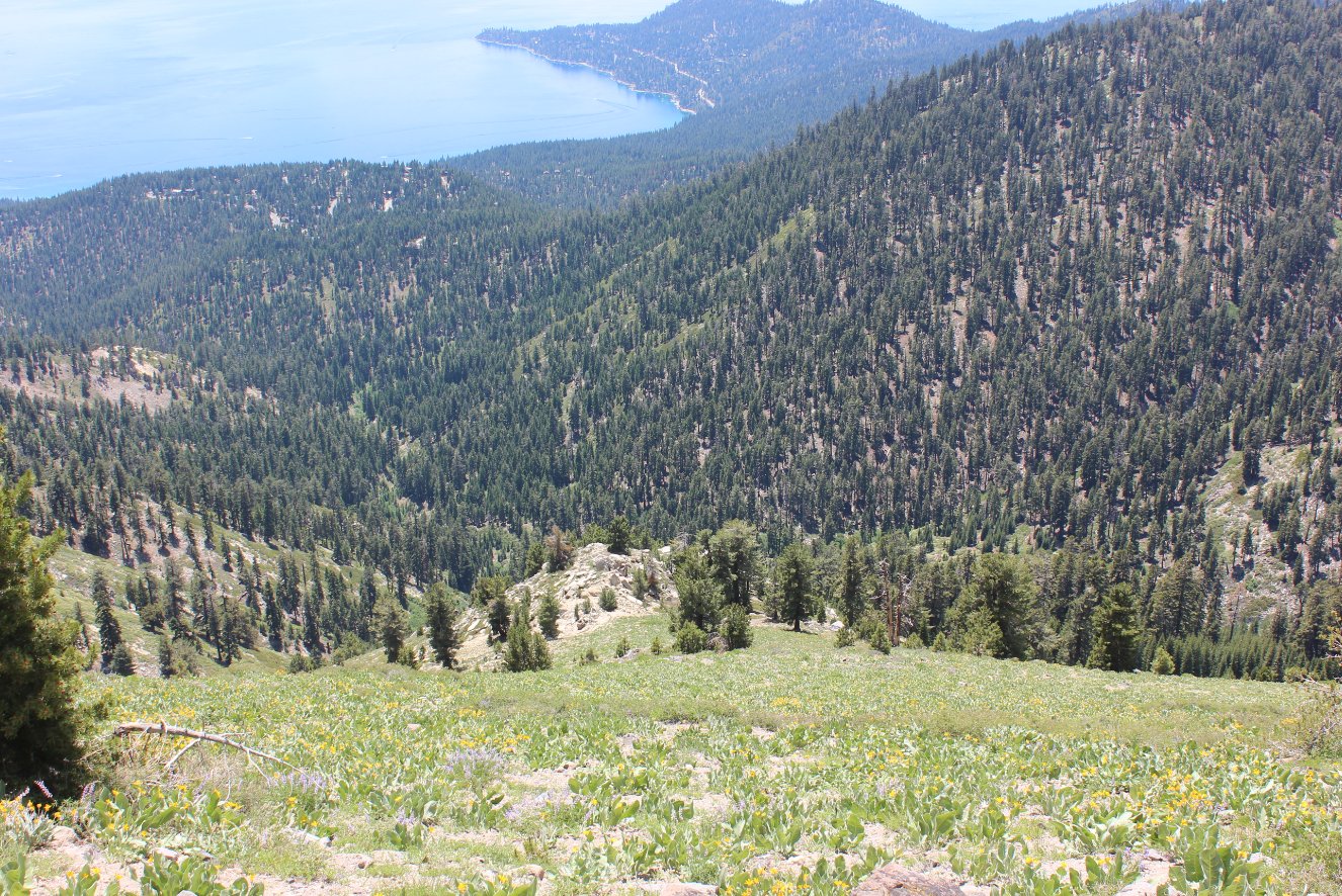
This great section of trail
climbed up through wildflowers on both sides to then present this vista
of Tahoe far below. |
 |
|
A close look at Crystal Bay
and Incline Village, a mere 2500' feet below the trail. |
 |
|
Into the Nevada side the trail
opened up from the forested area, and this rocky outcropping just south
of Rifle Peak offered an amazing lunchtime viewpoint. |
 |
|
The vista from where I stopped
for a lunch break, and offered a toast to my late father on his 87th
birthday. |
 |
|
Just when you thought the
trail couldn't possibly keep going up it does, around the southeast tip
of Rose Knob and then further up to Relay Peak. |
 |
|
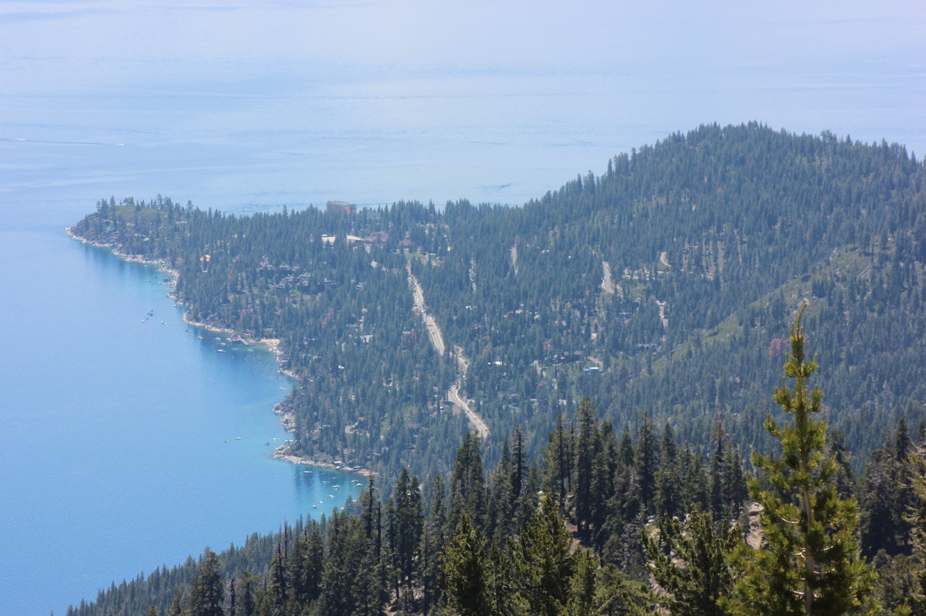
Looking down at the peninsula
that separates Crystal Bay from Agate Bay and Nevada from California. |
 |
|
Some have been known to access
this section of the TRT from down below here, a good 2500' feet below. |
 |
|
The first, and least enticing
water sources along this section of trail is here at Mud Lake.
|
 |
|
Even at this altitude of
almost 9600' feet the wildflower display just doesn't quit. |
 |
|
At each switchback spot there
is a tease as to where you need to get, the communications equipment
just over the other side of the actual Relay Peak (off to the right.) |

 |
|
Having
survived the grueling switchbacks on the south side of Relay Peak, I
can be seen trudging down the trail in search of a source of water to
replenish the 3+ liters I had already gone through on this day. |
 |
|
After that climb, there was no
question as to which way I was going to head from here, cutting a mile
off from the longer route. |
 |
|
Near Frog
Pond, this sign wasn't very helpful pointing out many ways to continue,
but heading the lower path is the one to take to get to Galena Falls
and a great source of year-round water. |
 |
|
There
are no words to describe how good it felt to hear and then see this
falls right where it needed to be to make sure I was able to replenish
my empty water bladder. Whew! |
 |
|
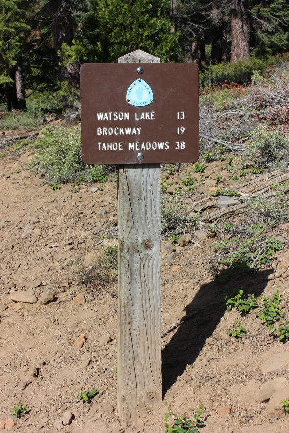
About
a mile from the end, I could see Tahoe Meadows, where the next section
of the TRT passes through on the way to Spooner Summit many miles
further to the south. |
 |
|
If
I were to ever do this section of hike again, which is enticing for the
fantastic views, I would start at this side and hike counter-clockwise.
A few miles of uphill followed by 15 miles of downhill would
be a
better choice on a warm summer day. |
 |
|
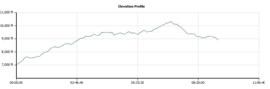
GPS track
of the hike starting in the upper left and heading to the right.
Almost all of the way is up, and this is the highest section
of
the entire TRT passing well over 10K feet in elevation near Relay Peak. |
 |
