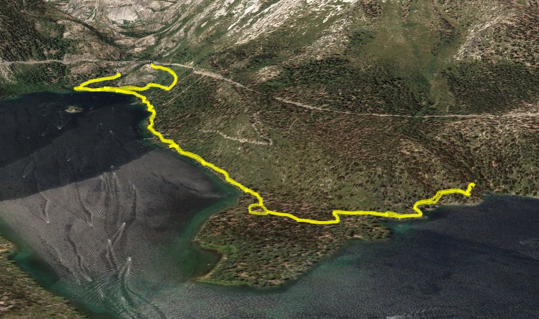
Distance: 7.0 Miles
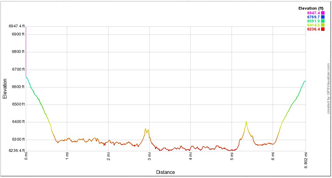
Vertical Gain: 400'
Group Size: 2
Hike Rating: Easy Moderate Hard Strenuous

 GPX
for
this trip
GPX
for
this trip
| Start Coordinates: | N 38 57.219, W 120 06.532 | End Coordinates: | Same as Start Coordinates | ||
| Car Shuttle Req'd: | No | Parking Directions: | Take Highway 89 north from South Lake Tahoe past Camp Richardson until you reach Emerald Bay. Head to the State Park parking area along the north side of the bay, just past the Eagle Falls trailhead parking. The lot will be on the right (south) side of the road. As of 2018, there was a $5 charge to park in the lot for the day. | ||
| Hazards of Note: | Steep drop-offs on trail which can be dangerous in winter or icy conditions. | Crowd Factor: | High. This is an extremely popular hike and one of the most popular in the Lake Tahoe area for visitors. Expect to have a significant amount of people on the trail. | ||
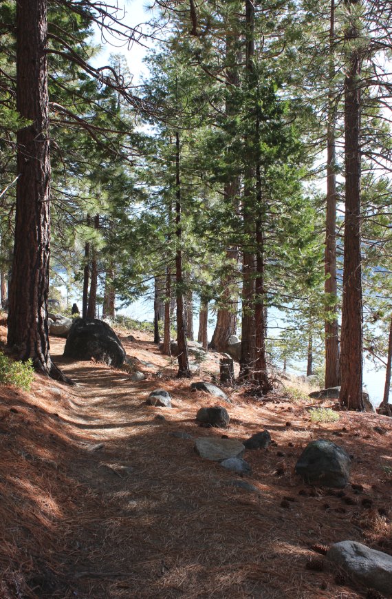
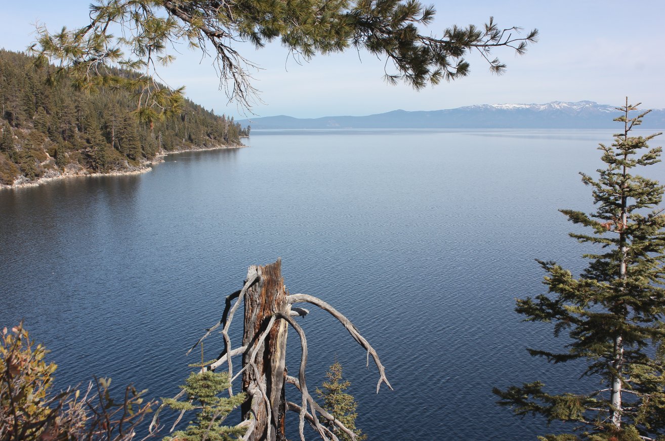
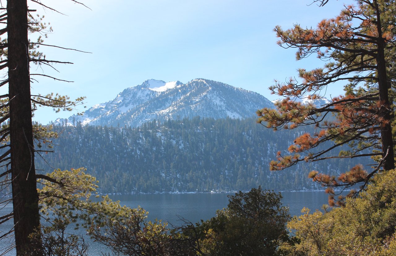
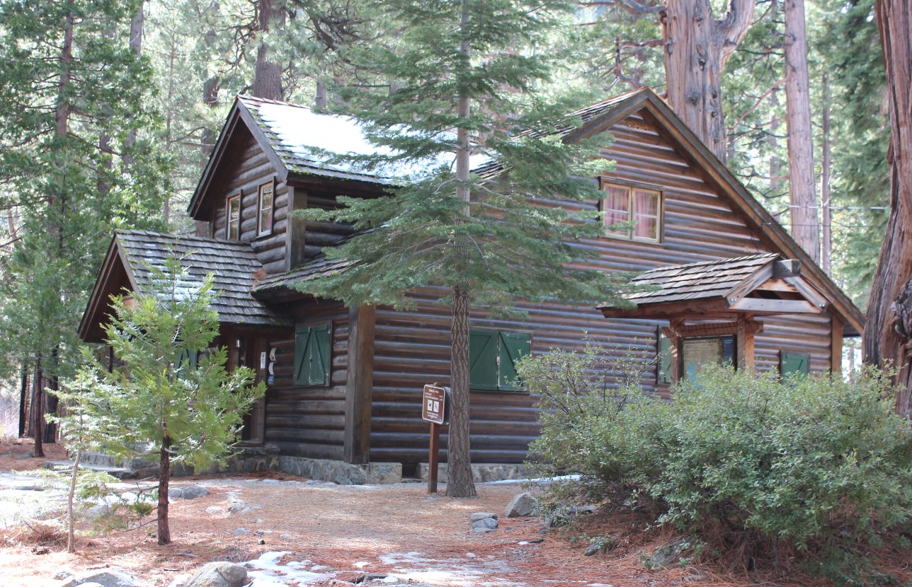
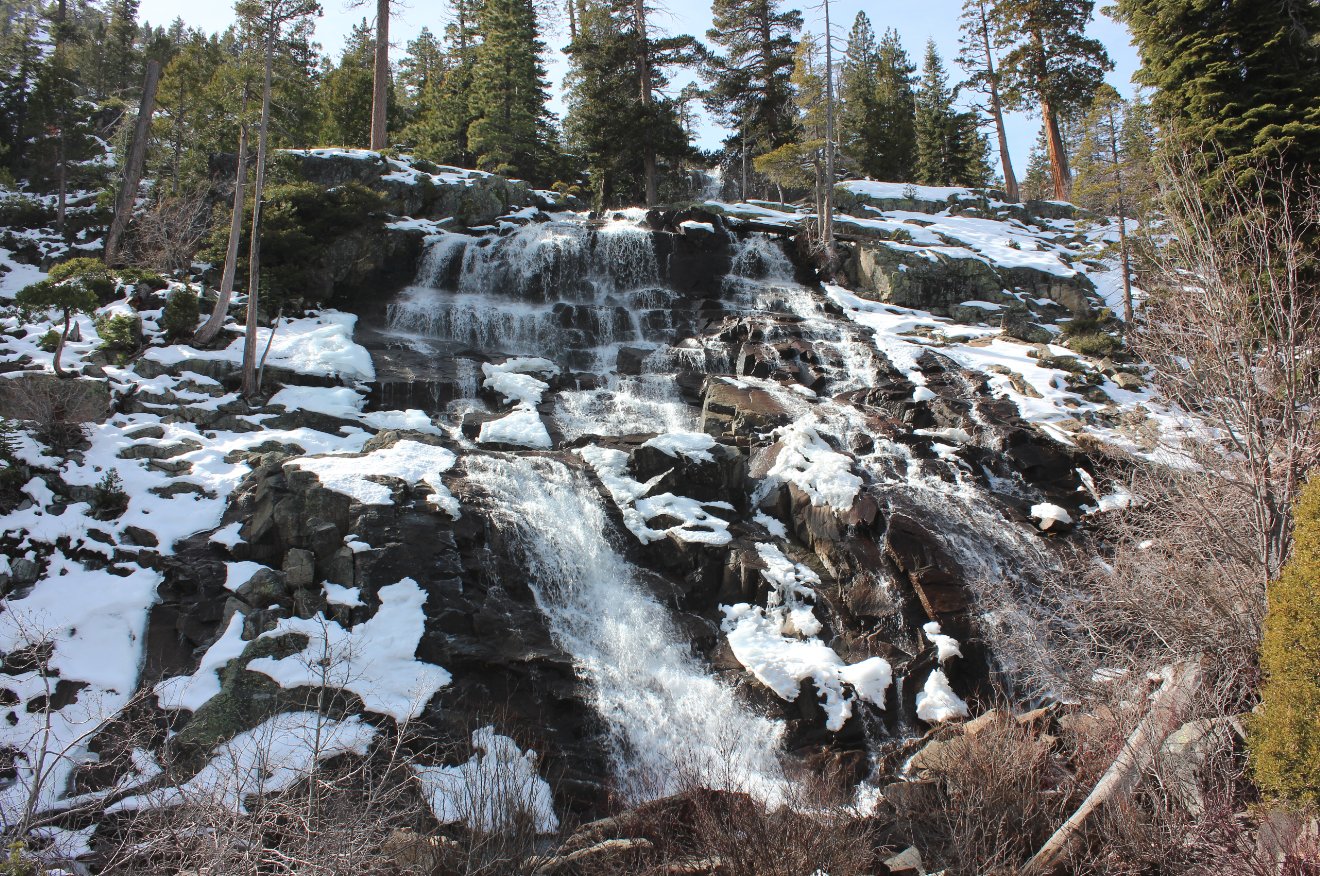
| General Notes: From the parking area head down the trail toward Vikingsholm Castle just past the parking pay kiosk at the eastern end of the lot. The first 3/4 mile down toward Vikingsholm is a constant downhill path, but then once you reach the bottom follow the signs toward the Rubicon Trail to the left. Make sure you don't turn left at the first junction, which is just a paved access road for the State Park workers. Once on the Rubicon Trail you will head along the north end of Emerald Bay, and then after about a mile cross a peninsula until you come out with amazing views of Lake Tahoe for the rest of the journey. Venture as far north as possible, with the trail finally ending at DL Bliss State Park after 8 miles. If having to return the same way, this will double the amount of distance on the hike for the day. In the wintertime or after a cold, wet overnight, you will probably want to have microspikes along due to the steep slippery condition of sections of the trail along the Lake Tahoe shore. |
|||||