
|
Mt.
Hoffman Hike
|
|
Trip Date: 08/18/2016
Distance: 4.2 Miles
Vertical Gain:
1500'
Group Size:
4
Hike Rating:
Easy
Moderate
Hard
Strenuous |

 GPX for
this trip
GPX for
this trip
|
|

|
Start Coordinates: |
N 37 50.673, W 119 29.498 from
May Lake
N 37 49.953, W 119 29.475 from May Lake Trailhead Parking Area (add 3
miles to trip) |
|
End Coordinates: |
Same as Start Coordinates
|
| Car Shuttle
Req'd: |
No |
|
Parking
Directions: |
Take Highway 120 (Tioga Pass
Road) through Yosemite National Park. There is a $30 fee as
of 2016 for a week's admission for one vehicle into the park.
Take the signed May Lake Trailhead parking road which is 2
1/4 miles west of Olmstead Point and follow it 1 3/4 miles to
the trailhead parking area. The hike to May Lake is just
under a half mile from this spot, which will be the official start of
the hike up to the top of Mt. Hoffman. |
| Hazards of
Note: |
From May Lake the peak is only
about 2 miles away, but it is almost a constant steep uphill climb for
the last mile. The scramble to the peak on the east side is
class 3 and will require climbing up some large boulders. |
|
Crowd Factor: |
High. This is one of
the main day hikes from the popular May Lake area, and you will meet
many people on their way to summit this peak in the geographic center
of Yosemite. |
General Notes:
From
May Lake High Sierra Camp at the southeast corner of the lake, head
clockwise around the south edge of the lake until you see the trail off
to the left when you are approximately on the western edge of the lake.
The first half mile takes you uphill at a gradual rate,
passing through a spring-fed meadow early on and then offering some
nice vistas just off the trail to the left when you come out to an open
granite area. Once you pass this area, the trail then turns
sharply to the right (north,) and your steep ascent over the next mile
will begin. The way is marked pretty well with rock cairns
(stacked rocks,) but if you don't see any just continue to head upward
to the left of the granite rises which falsely appear to be Mt. Hoffman
from the start of the hike. About a third of a mile from the
peak you will come up to an open area once again, which flattens a bit
and leads you on a gravelly path through open tundra toward the peak.
This area is resplendent with Marmots, which we saw nearly 10
casually eating and paying us no attention.
At the rocks which lead up to the final peak (obvious due to the radio
antenna on top) you will have to find your way as best as you can to
attain the summit. Both the right and left side routes as
marked by previous summit climbers are about the same and do not offer
any advantage for one over the other.
|
|
|
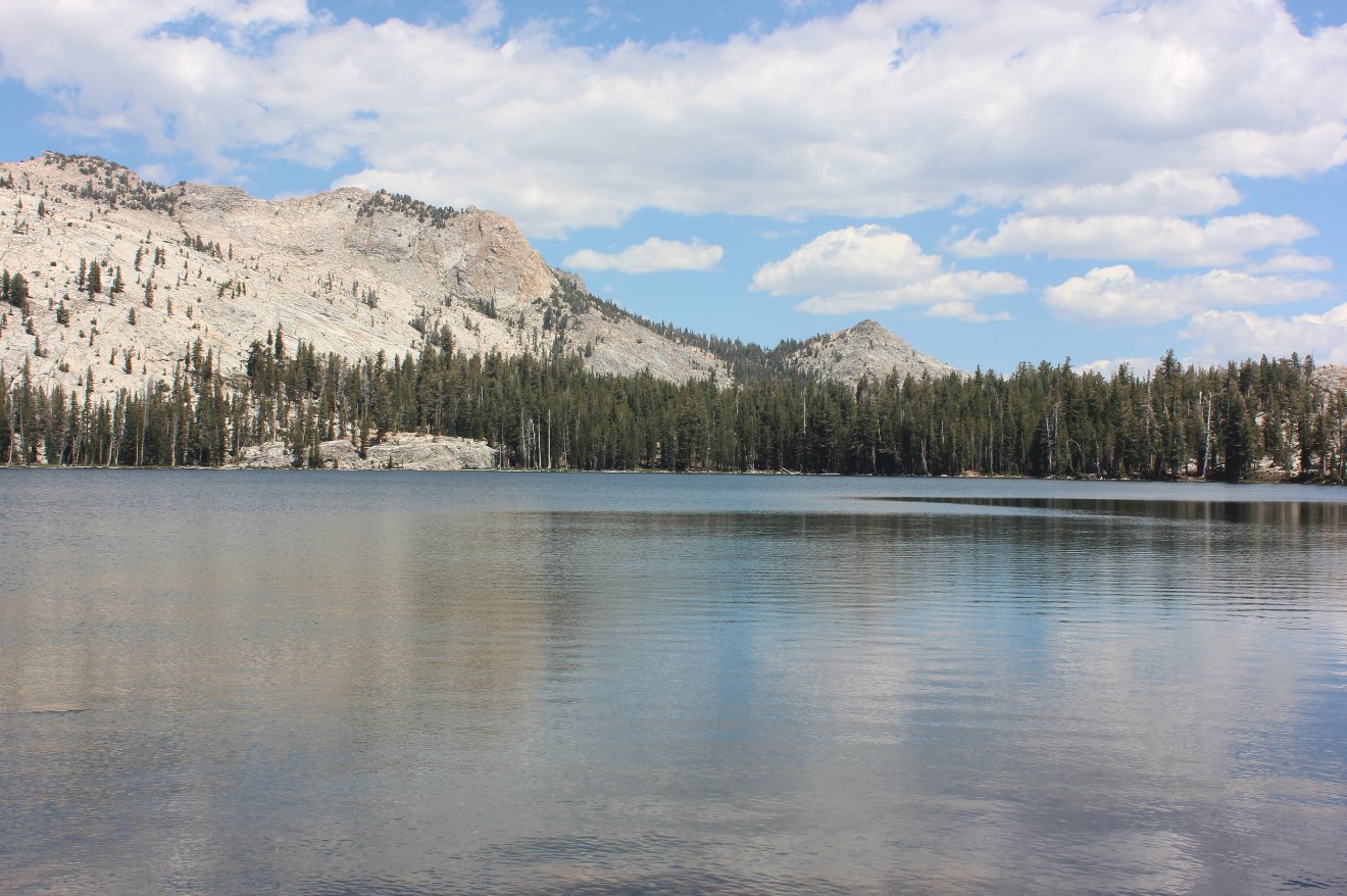
One last look at May Lake
before heading up the trail to the summit which is found at the far
west end of the lake. |
 |
|
After a first relatively
pain-free climb a look back shows just the far edge of May Lake and
gives you an idea of how much elevation still remains ahead of you.
|
 |
|
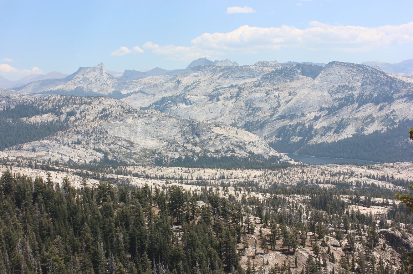
Stepping off the trail to the
left in the first open granite area about 1/2 mile along the trail
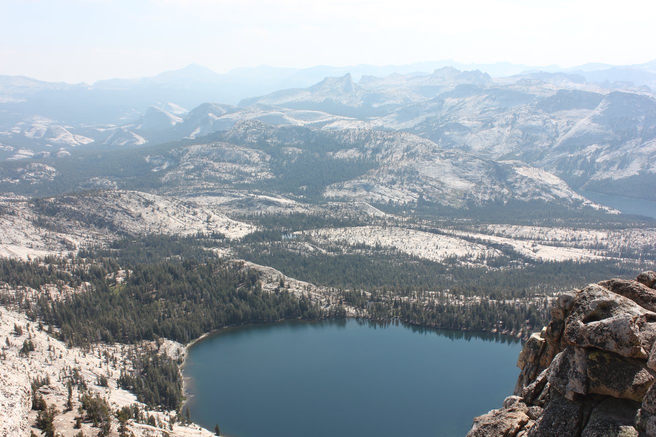
offers some pretty amazing views, including this one of Cathedral Peak
and the area toward Sunrise Mountain to the Southeast. |
 |
|
Staying at Mt. Hoffman in a
previous year I had been told the peak above the lake visible from
below was the actual mountain. It isn't, and the trail skirts
along the south side of it before climbing up and past the faux Mt.
Hoffman's western flank. |
 |
|
This climb up the west flank
of the fake summit can be described in three words: steep, steep,
steep. It is slow going, and best to hit this part in the
morning because it is exposed to the sun with little to no shade on the
way. |
 |
|
The nice part about climbing
up is you are almost always rewarded with amazing views all around.
At the point where the steepness mellows out a bit in favor
of more gradual ascent along a gravel area you can look back and see
Cloud's Rest and Half Dome in the Southwest distance. |
 |
|
The actual Mt. Hoffman peak
soon comes into view, as you make your way up an open, gravelly section
of trail toward the saddle just to the right of the peak.
|
 |
|
We found the best access to
the summit to be pretty close to the far right of the rocks heading up
to the radio tower on the top. |
 |
|
The last bit of climb to the
top is not terribly dangerous, but it does require careful navigation
of large rocks and making sure you don't find a granite slope too
slippery to easily negotiate. |
 |
|
At the top are views into an
area of Yosemite (and beyond) which I have yet to explore.
The mountsins to the northeast of the peak are extremely
rugged from this vantage point. Also visible in the nearest
ridge is a white spot which is the location of a calcite cave which is
another day hike destination from May Lake for the exceptionally
adventurous.
|
 |
|
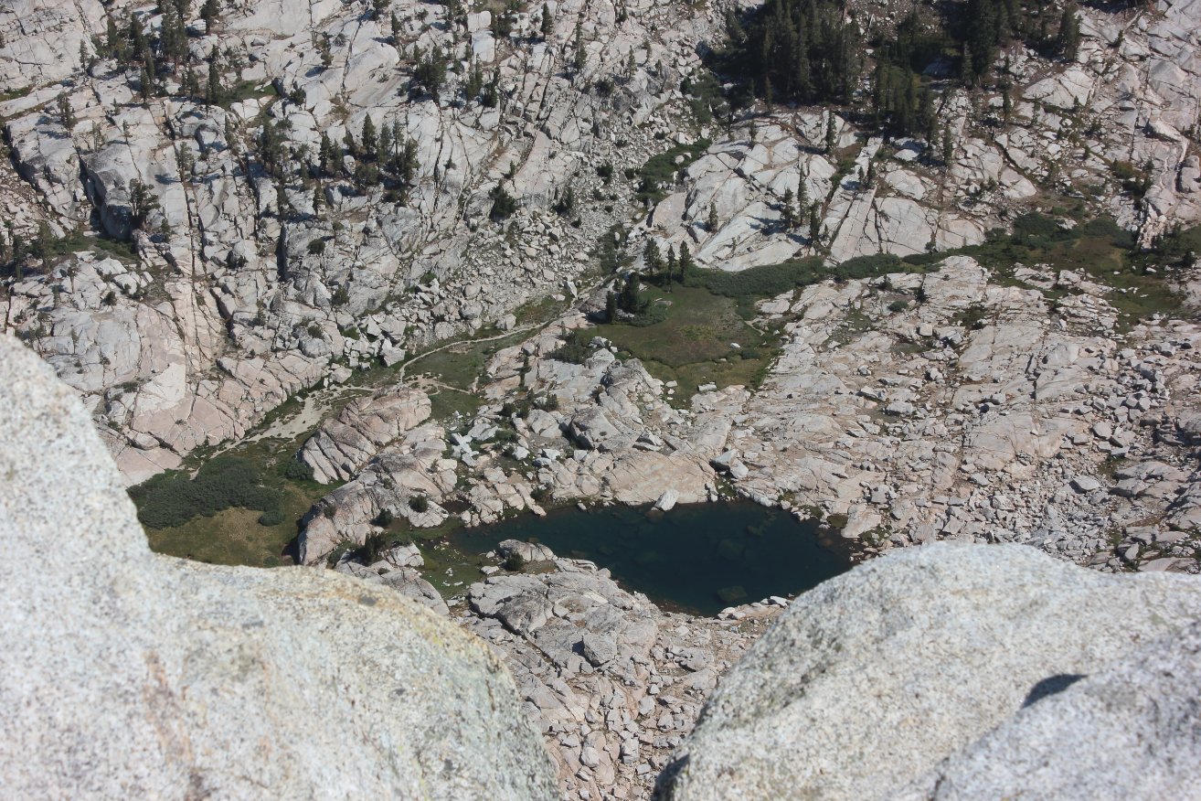
Just north of the peak was a
tarn unnamed on the map, but sporting a trail along the north edge
distinctive enough to show many have been to this remote location. |
 |
|
Myself taking in the amazing
views and successfully blocking any look at Cathedral Peak to the east. |
 |
|
One last look at Half Dome
from the summit and one of the nearby 'stacked' rock formations all
around the area. |
 |
|
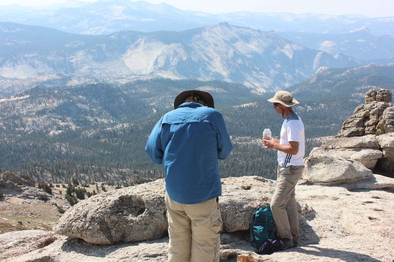
Mark and Phil enjoying lunch
after the hard work exerted getting to the top of this peak in the
exact center of Yosemite National Park. |
 |
|
A shot of Mark heading back
down a little to the left of where we came up (looking at the peak from
below.) It was no worse or better than the way up, but did
give us a chance to check out some of the amazing rock formations which
look like they were stacked on top of each other. |
  |
|
After
dropping down from the summit but before heading back down the trail,
continue up a use trail to the east to find yourself in a surprising
open plateau behind the faux Mt. Hoffman summit visible from May Lake.
In fact, head to the rocks and you can look down and see May
Lake
far below. |
 |
|
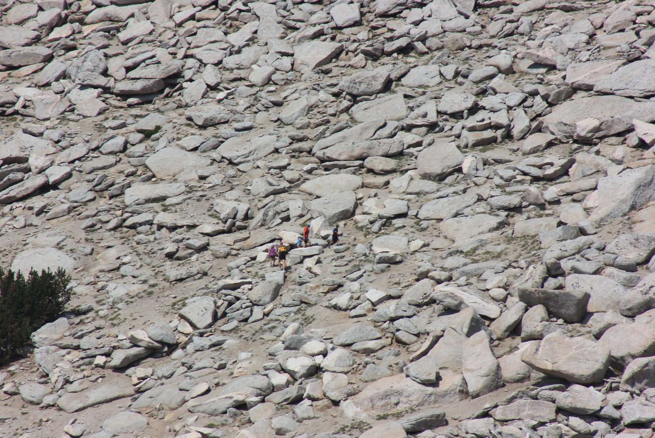
While
perched high above May Lake, we amused ourselves by watching a family
of five make it up to the summit of Mt. Hoffman. The youngest
appeared to be 7 or 8 and was often handed from mother to father on
some of the larger boulders. |
 |
|
Even on this late August day
there were a number of wildflowers and greenery enjoying the benefit of
a nearby spring. |
 |
|
GPS Track of the full hike. |
 |