
|
Lyell
Canyon to Vogelsang High Sierra Camp Hike
|
|
Trip Date: 08/19/2015
Distance: 11.2 Miles
Vertical Gain:
350'
Group Size:
6
Hike Rating:
Easy
Moderate
Hard
Strenuous |

 GPX for
this trip
GPX for
this trip
|
|

|
Start Coordinates: |
N 37 44.342, W 119 24.389 |
|
End Coordinates: |
Same as Start Coordinates
|
| Car Shuttle
Req'd: |
No |
|
Parking
Directions: |
The
parking for the Lyell Canyon trailhead is at Tuolumne Meadows,
just a little west of the Tuolumne Meadows Lodge.
To
get there, take
Highway 395 south from Monitor Pass toward Mono Lake. At Lee
Vining, turn on Highway 120 (Tioga Pass) and enter Yosemite Park on the
east side. About 10 miles into the park turn at the
Wilderness
Permit area (Tuolumne Meadows Lodge Road) and continue to the parking
coordinates for backpacker vehicles. |
| Hazards of
Note: |
None. |
|
Crowd Factor: |
Medium.
The first 5 1/2 miles up Lyell Canyon is along the John Muir
trail, and is a relatively popular backpacking area on the way between
Yosemite and Mt. Whitney further to the south. Once the trail
leaves and heads up toward Ireland Lake and Vogelsang High Sierra Camp,
the number people you will encounter drops significantly. |
General Notes:
From
the parking area near the lodge, cross over the road and find the
signed trailhead for the John Muir Trail. What follows for
the
next 5 miles is a pleasant journey along the JMT as it
meanders
it's way up Lyell Canyon, along the river which is never too far from
you on your left. At the junction for Vogelsang HSC just near
the
base of Potter Point, the trail quickly changes from a casual stroll to
a truly strenuous climb of almost 2000' in the next 4-5 miles.
It
is a rigorous hike, and frequent breaks to catch your breath in the
high altitude and some water are highly recommended. Two
miles
after the climb begins there is a tempting side journey to Ireland
Lake, but unless you are going to spend the night there, that will add
another two miles to the day's long trek.
Another
mile further you will pass along the shores of Evelyn Lake, and then
begin to drop slightly back down to Vogelsang High Sierra Camp at just
a little over 11 miles from the start, at the elevation of 10,300 feet.
This is a very strenuous hike, and we were the only ones in
camp
who had attempted to attain Vogelsang camp via this method as opposed
to coming up the Rafferty Creek trail, which is much shorter.
|
|
|
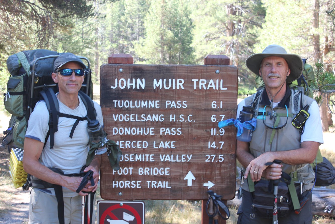
At the John Muir Trailhead
near Tuolumne Lodge. The mileage to Vogelsang here is about 5
miles shorter than the path we took up Lyell Canyon. |
 |
|
Crossing the river just past
the trailhead, and saying goodbye to most of the only people we saw
along the way.
|
 |
|
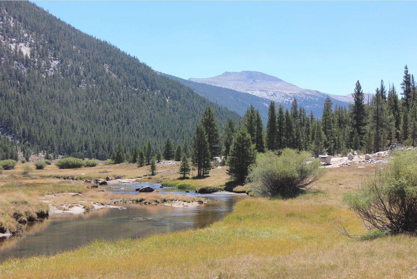
Starting up the Lyell Canyon
is where the topography really opens up into a wide, glacially-carved
valley. |
 |
|
These pack mule trains are the
primary method for getting supplies to and from the High Sierra Camps
during the summer months. It's wise to give them a wide berth
along the way. |
 |
|
For the five miles hiked
through the Lyell Canyon, there is very little elevation gain, and lots
of water. Even in this drought year. It is a good
idea to stay hydrated and carbo-load in preparation for what lies ahead.
|
 |
|
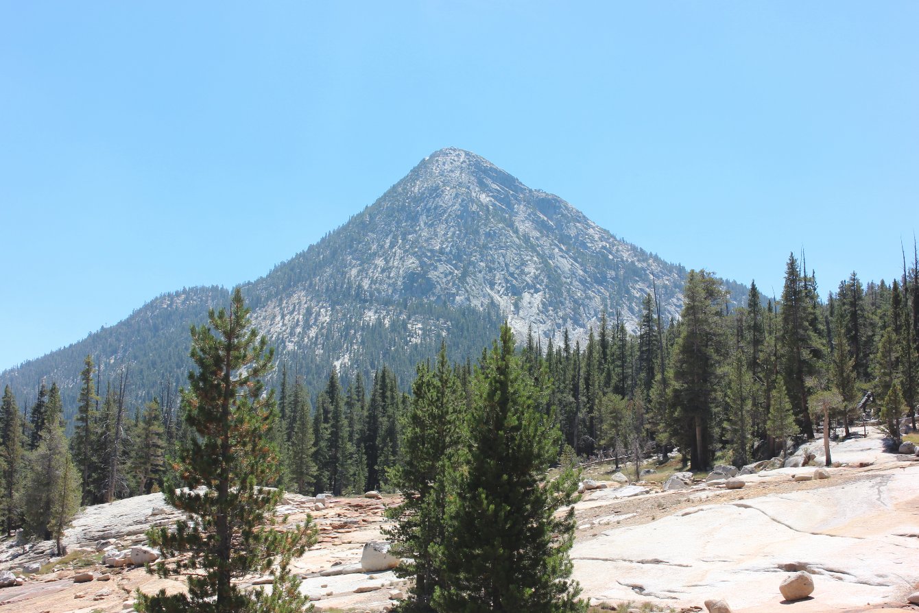
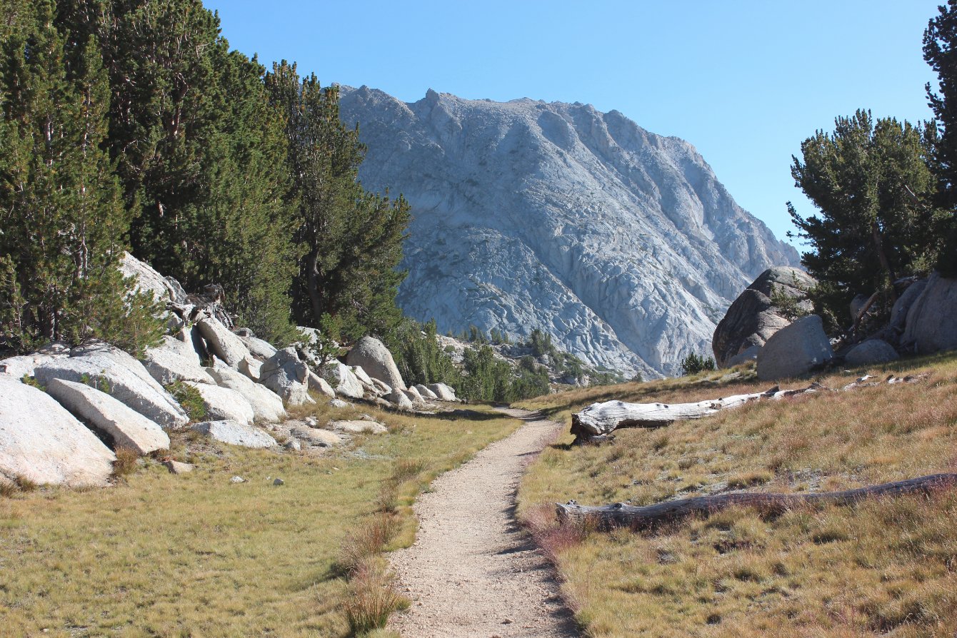
Potter Point is an impressive
peak jutting out above the trail, which the path to Vogelsang High
Sierra Camp splits just in front of. However, it does feel
like you are climbing this peak (and more) on the second half of this
trail. |
 |
|
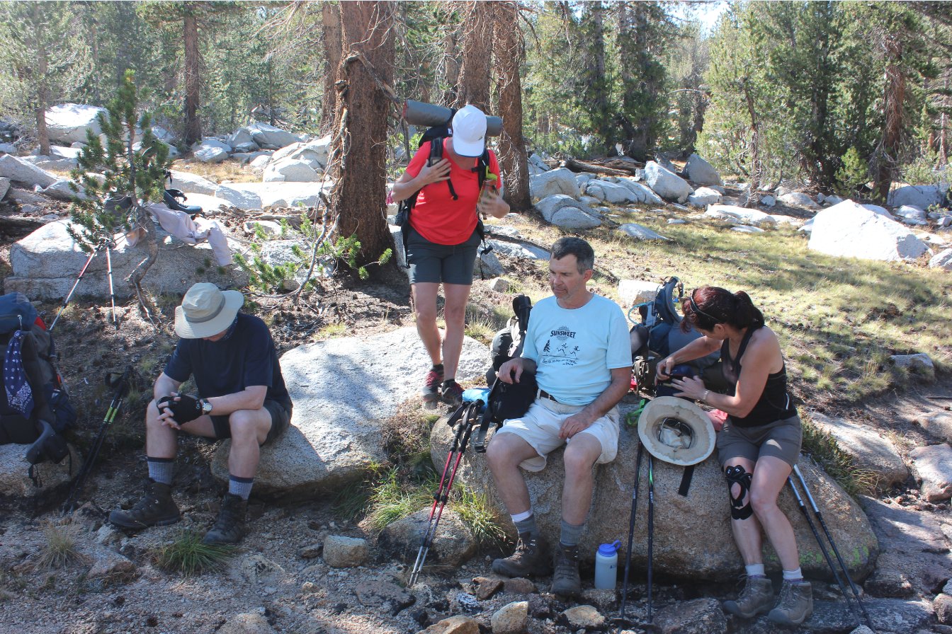
Extremely necessary, and very
welcome are short rests as the trail begins to gain significant
elevation after leaving the long stretch of Lyell Canyon far below.
|
 |
|
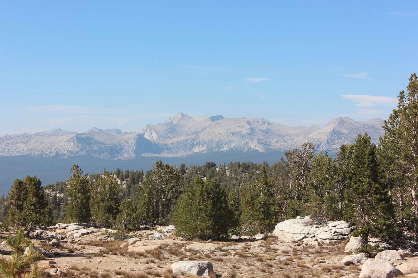
The advantage of constant
climbing is that the views open up tremendously. Across the
valley to our east are Ragged Peak, White Mountain, and Gaylor and
Tioga Peaks in the distance. |
 |
|
And the views got even better
and further as we made our way up to the elevation (but still a mile
from) Ireland Lake. |
 |
|
Finally we got high enough to
see Mt. Conness and the range which separated us from the 20 lakes
basin to the east. |
 |
|
Finally reaching Evelyn Lake,
the majority of the climb for the day was over and it was just another
mile and a half to camp. |
 |
|
Past Evelyn Lake the trail
stayed mostly level, heading toward Fletcher Peak, which the Vogelsang
HSC is situated at the base of. |
 |
|
Below Fletcher Peak was the
welcome sight of tent cabins at the Vogelsang HSC. After
checking in we went out and found a good campsite to set up and finally
rest after a very long, strenuous hike up from Tuolumne Meadows. |
 |
|
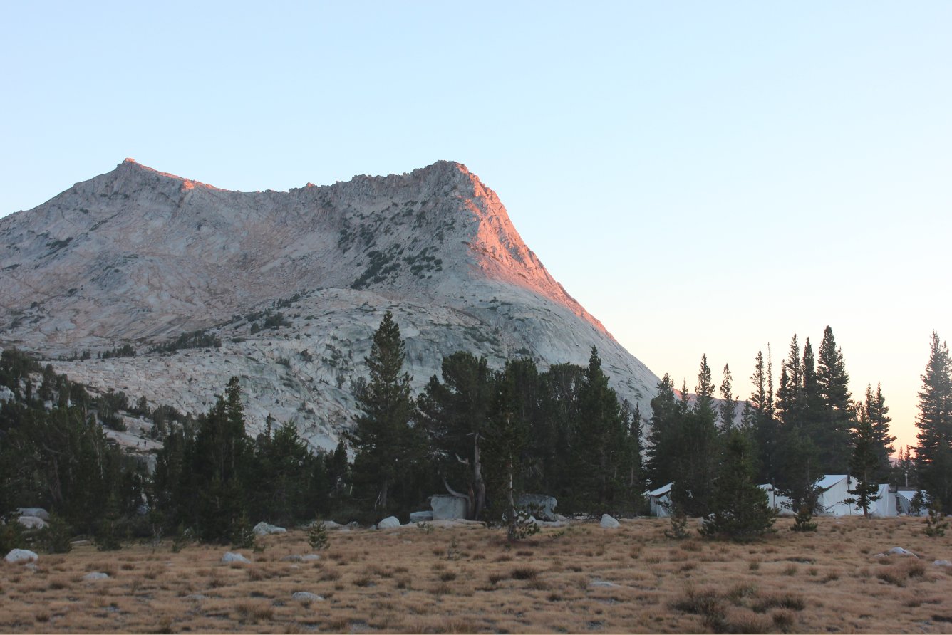
From our campsite we could
plan our route up to the top of Vogelsang Peak (on the left,) which was
to be our destination for the hike the next day. |
 |
|
This sunset from camp was our
reward for the hard work put in on the day. As was the
fantastic meal of salmon we had at the camp that night. |
  |
|
GPS Track of the full hike. |
 |