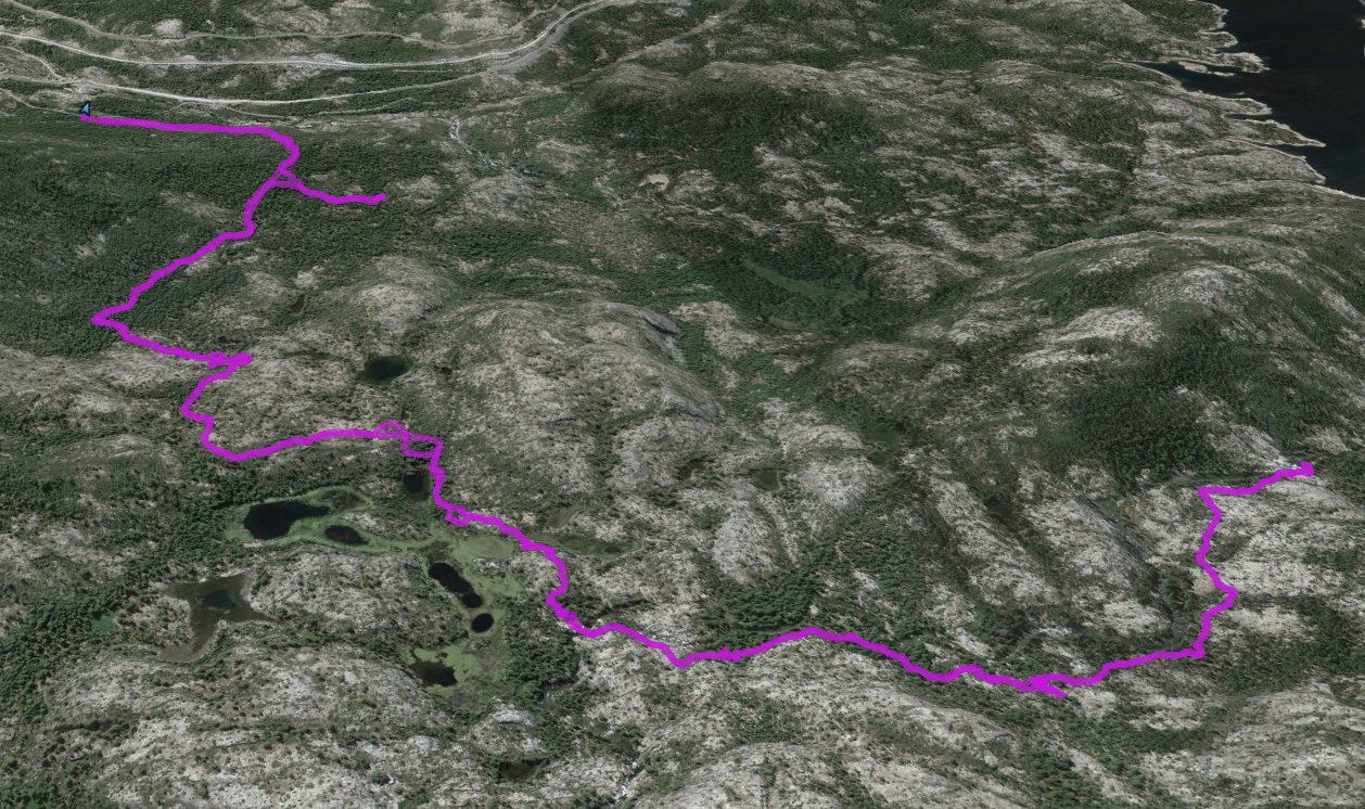
Distance: 10.8 Miles
Vertical Gain: 670'
Group Size: 2
Hike Rating: Easy Moderate Hard Strenuous

 GPX for
this trip
GPX for
this trip

| Start Coordinates: | N 39 19.822, W 120 34.218 | End Coordinates: | Same as starting coordinates | ||
| Car Shuttle Req'd: | No | Parking Directions: | Take Highway 80 to the Eagle Lakes exit just west of Cisco Grove. Turn left back under the freeway, and the road will bend to the left. Follow the road for a half mile until you see the sign for Eagle Lakes OHV area on your right. Drive through the gate and park anywhere off the road so as to not block any vehicle & jeep traffic. | ||
| Hazards of Note: | Jeep traffic on the way to Eagle Lakes during the summer months, as well as mosquitos during the spring and early summer near the lakes. | Crowd Factor: | Moderate. Foot traffic will be limited, especially past the Eagle Lakes area, but there will be jeepers on the way to Eagle Lakes that you will have to give the right of way to. | ||
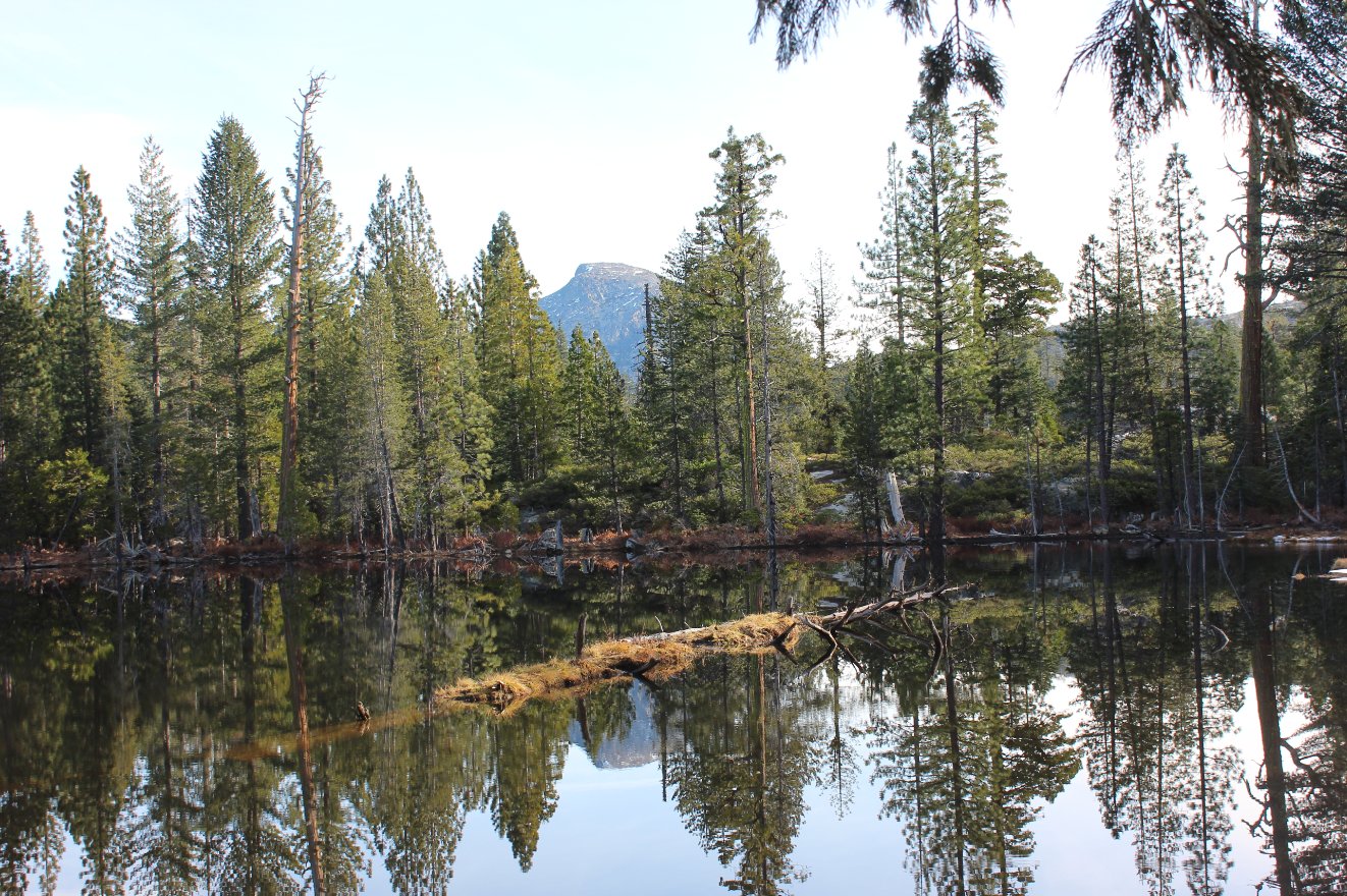
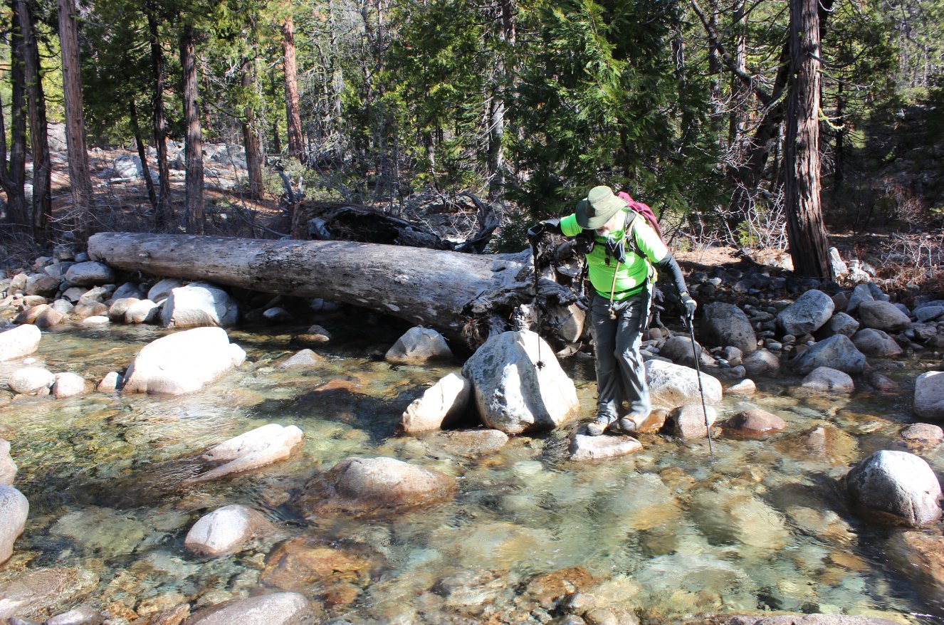
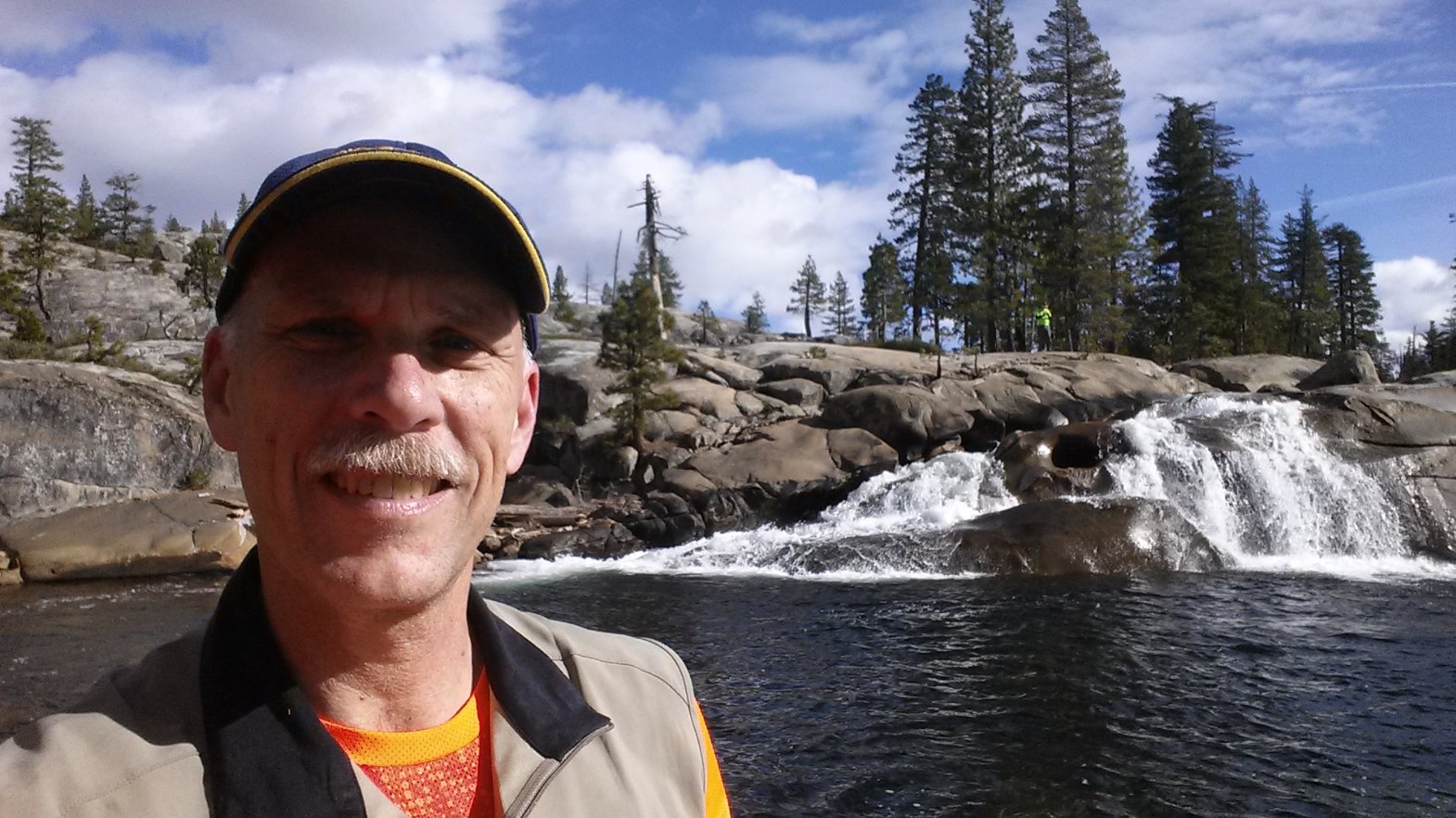
| General Notes: From the parking at the trailhead, head west on the road until you pass by a gathering area for 4x4 vehicles attempting the drive along the route. From this point on for about the next two miles you will be in relatively dense forest, hiking along the road which has some minor elevation gain but nothing more than a few hundred feet at a time. Take the right fork when you get to a signed intersection for the Pierce OHV trail (don't go that way.) Eagle Lakes will be reached in about 3 1/2 miles from the trailhead, and stay on the jeep trail which heads a little to the left when you get to another junction just a little before the lakes. Pass through the middle of a series of small lakes with nice reflective views of Old Man Mountain and Signal Peaks on your right. Once past the lakes you will see a "Stop" sign on the jeep trail, with an indication that you will now be passing into private property and the request to be respectful of the area (i.e. no motor vehicles from this point on.) The trail narrows down to single track at best from this point, and another 1/2 mile ahead you will cross a surprisingly stout bridge across Fordyce Creek. Turn to the left after crossing the bridge and continue on for another mile and a half to the falls, crossing creeks a couple of times on the way. At the falls there is ample granite for sunning and enjoying lunch, and be sure to drop down to the base of the falls for great views back up at the falls and the granite all around you. |
|||||

