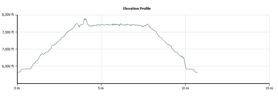
Distance: 10.6 Miles
Vertical Gain: 1800'
Group Size: 2
Hike Rating: Easy Moderate Hard Strenuous

 GPX for
this trip
GPX for
this trip
| Start Coordinates: | N 39 14.124 W 119 55.799 | End Coordinates: | Same as Start Coordinates | ||
| Car Shuttle Req'd: | No | Parking Directions: | Park right on the west side of
Highway 28 (Tahoe Blvd) just across from the intersection with Tunnel Creek Road. The Tunnel Creek Cafe is directly across the street from this location, and offers car shuttles for those wanting to make this a one-way trek from Spooner Lake. |
||
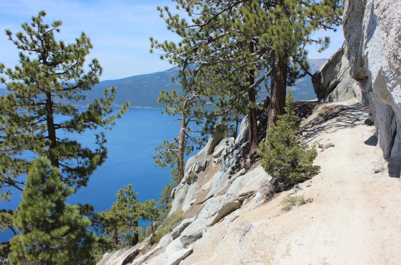
| Hazards of Note: | Steep dropoffs Long sections with little shade Significant early elevation gain |
Crowd Factor: | Busy, especially on weekends. This is a very popular mountain biking trail. | ||
| General Notes: This trail starts off on the paved Tunnel Creek road, which quickly turns into a dirt road for a couple of miles before veering off to become the Marlette Flume Trail near a historical explanation sign about 2.9 miles into the hike. A little bit past this turn is a trail junction, where one can continue on the Flume trail, head up toward the Tahoe Rim Trail or off toward Twin Lakes. Keep on the path to the right to continue on the Flume hike. The trail soon gets to a narrow section, where even bikers will have to walk their bikes due to rocky sections and a very narrow trail at times. The drop-offs are significant, but the views of the entire Lake Tahoe area are outstanding. The elevation change at this point is negligible, making for very easy hiking along the flume section itself. Most mountain bikers are heading north from Spooner Lake, so they are easy to avoid. On the way back, you need to keep a sharp ear out for them, especially on the significant downhill section in the last three miles as they can build up a lot of speed and be unable to stop on the gravelly trail. |
|||||