
|
Echo
Peak from Angora Trail Hike
|
|
Trip Date: 11/01/2016
Distance: 12 Miles
Vertical Gain:
2200'
Group Size:
5.75
Hike Rating: Easy
Moderate
Hard
Strenuous |

 GPX for
this trip
GPX for
this trip
|
|

|
Start Coordinates: |
N 38 52.777 W 120
04.247 |
|
End Coordinates: |
Same as Start Coordinates
|
| Car Shuttle
Req'd: |
No |
|
Parking
Directions: |
Drive
all the way to the west
end of Fallen Leaf Lake Rd, and turn onto Glen Alpine Rd up to the
small firehouse on the left side of the road. There are four
spots across the road from the firehouse, and the trail can be found
just to the east of the building. |
| Hazards of
Note: |
All of the trail to the top of
the peak from the Angora Lakes is a scantily-marked use trail often
visible only by cairns. |
|
Crowd Factor: |
Moderate at the start, and
then exceptionally crowded at the Angora Lakes during the summer.
Once headed up toward the peak, you will most
likely run into nobody except for a few at the peak. |
General Notes:
The
first mile and a half of this hike is along the Angora Lake Trail (also
known as the Clark Trail,) and gains significant elevation along the
way. The trail then ends at the Angora Lakes parking area,
and you can follow the dirt road up past the first lake, Lower Angora,
on your left until you reach the Angora Lake resort on the east shore
of the Upper Angora Lake. Find a use trail very close to the
eastern side of the lake heading south, and then head up the rocky
south side of the lake until you reach a large depression of sandy
granite forming a large bowl about 400 feet about the lake.
From here, you will look for cairns to guide you up the next
1000' of elevation gain, until you finally reach the ridgeline about
500 feet south of the peak. Follow the well-worn path to the
peak from here, and then head back down the same way to complete this
relatively short but very strenuous trek to the peak.
If you go past Echo Peak you will enter Desolation Wilderness, and in
that case you will need a day permit and the group
size limit is 12. |
|
|
It might be a little hard to
spot at first, but look for this sign just to the east of the Fallen
Leak Lake firehouse and you will head due south over a small bridge and
head up the Angora/Clark Trail |
 |
|
A picture of the trailhead
sign and bridge during the summer shows that it will be much easier to
spot with everything green surrounding the location. |
 |
|
Be sure to turn back along the
way up to get changing perspectives of the area and the lakes you will
soon tower above, including this early one of Fallen Leaf Lake. |
 |
|
Lower Angora Lake is quite peaceful once the summer crowds have disappeared for the season. |
 |
|
Looking
west across Upper Angora Lake shows the type of terrain that now exists
between yourself and the destination of Echo Peak shown here, about
1200' feet above this spot. |
 |
|
On the
very steep use trail to the top, you gain elevation quickly as you can
now see by how high above Angora Lake we soon find ourself. |
 |
|
Even further up now, we get a view not only of Angora Lake but Fallen Leaf and Lake Tahoe in the distance. |
 |
|
On the
way to the ridgeline be sure to stay to the south of the peak, shown
here from just about 500' below the top because the terrain immediately
below it can be serious trouble. |
 |
|
Once at
the top you can actually see five bodies of water. A small tarn
on the left below the peak, Upper and Lower Angora Lakes, Fallen Leaf
Lake past that and then Lake Tahoe furthest out. Angora Peak is
the light brownish one in the middle and you can see the scar from the
Angora fire on the far right. |
 |
|
The stay at the peak on this November day was spectacular, with hardly any wind and views all around that can't be beat. |
 |
|
Our group met up with another hiker who actually has used this website in the past for ideas and adventures in the Tahoe area. |
 |
|
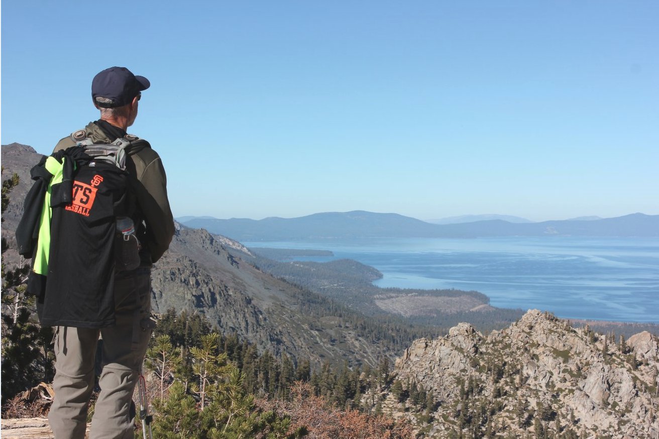
Phil, who's birthday was on this day, enjoying the amazing view of Lake Tahoe off to the east. |
 |
|
To the
west is the gorgeous Crystal Range, with Pyramid Peak furthest left, as
well as Agassiz, Price, Little Pyramid and pat of Jack's Peak visible
in this shot. |
 |
|
This shot
of the group heading back down the use trail shows just how steep this
trail really is. It's a challenge on the way up for certain. |
 |
|
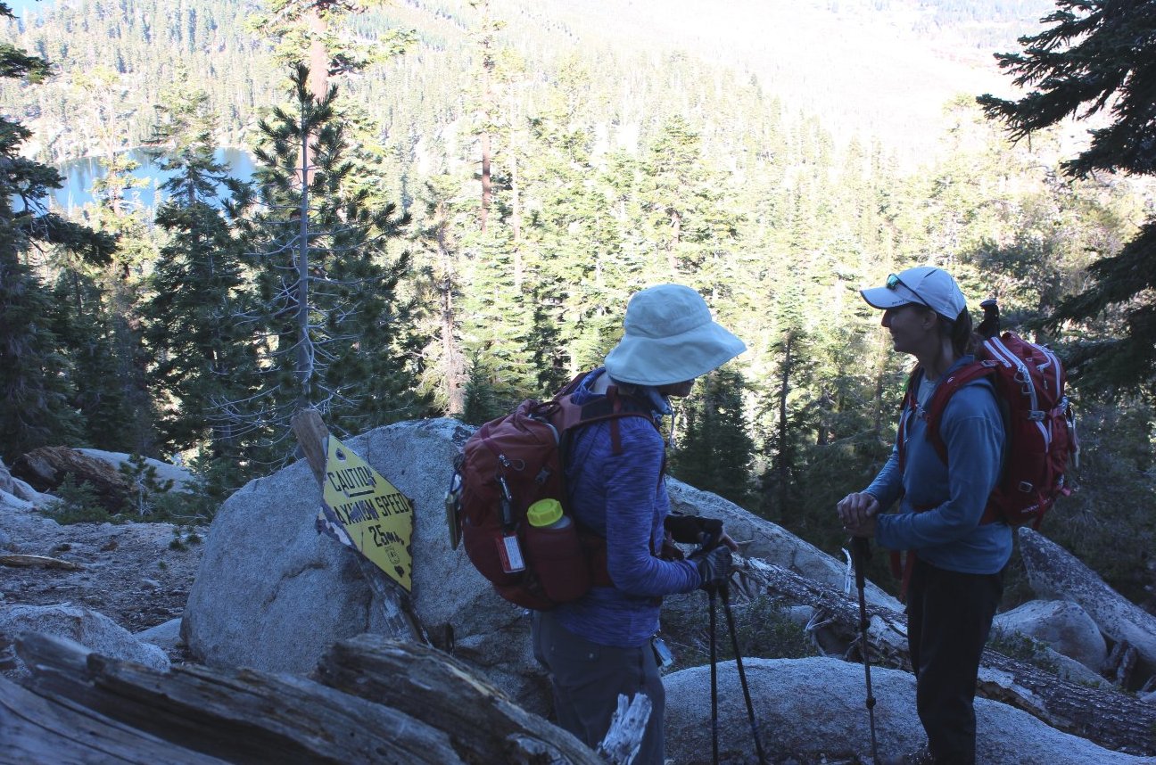
Finding this roadsign on the way back down was an unexpected and unexplained incident. |
 |
| Almost back to the Angora Lakes, but the elevation gain/loss is significant all of the section from the peak back to Angora. |  |
|
GPS track of the hike,
starting at the bottom left and heading up to the top of the pass in
the upper right. |
 |