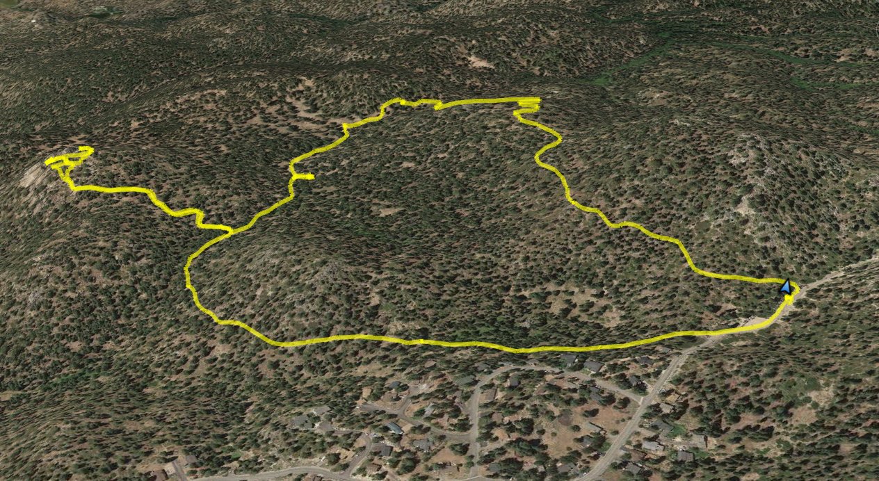
Distance: 4.0 Miles
Vertical Gain: 700'
Group Size: 3
Hike Rating: Easy Moderate Hard Strenuous

 GPX for
this trip
GPX for
this trip

| Start Coordinates: | N 38 59.779, W 119 53.794 | End Coordinates: | Same as Start Coordinates | ||
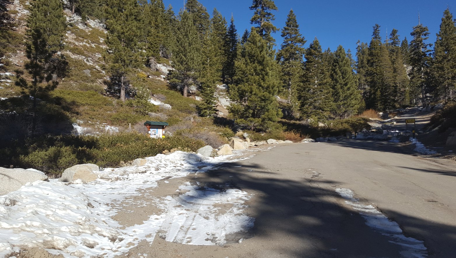
| Car Shuttle Req'd: | No | Parking Directions: | For parking at the Castle Rock trailhead (Kingsbury North,) take Highway 207 east from Lake Tahoe Blvd for a couple miles, and then turn left on N. Benjamin Dr. Follow this road around (it turns into Andria Dr at one point) until you reach the end of the pavement and the parking area for the Tahoe Rim Trail hike. | ||
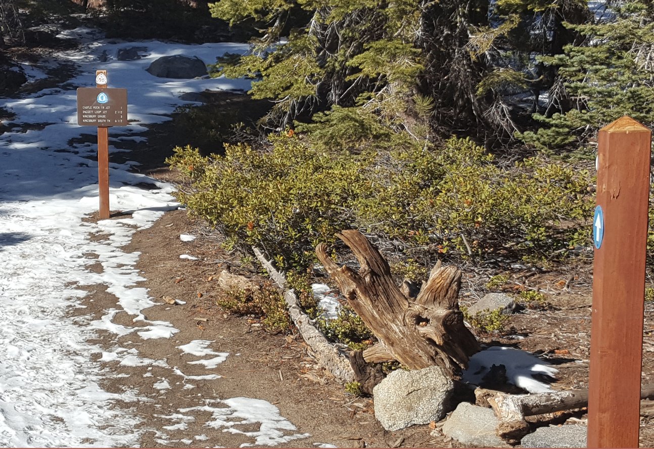
| Hazards of Note: | There are a number of TRT junctions along the way so be sure to keep following signs toward Castle Rock. | Crowd Factor: | Moderate; popular with dog walkers | ||
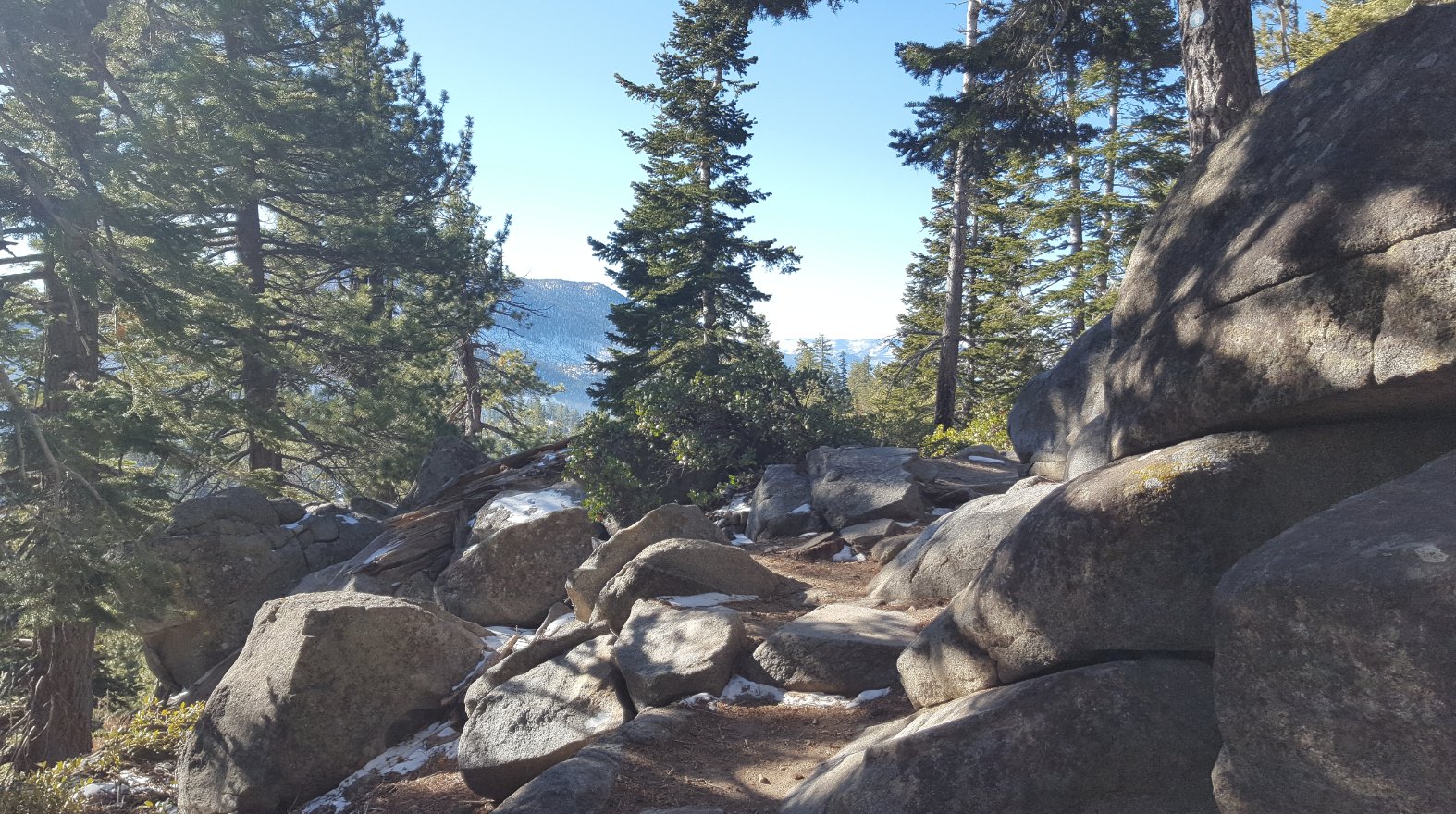
| General Notes: Start the hike at the Tahoe Rim Trail kiosk near the western side of the parking area. The trail will head uphill almost immediately, and then begins a trek through a forested section over the first mile. To the south there will be views of Monument Peak at the HEavenly Valley Ski Resort, and you can even see Freel Peak and Job's Peak behind it on a clear day. The first junction will have the Tahoe Rim Trail heading to the right, and you will continue straight along your current trail. About a quarter mile past this will be the junction to another trail, and you will want to stay to your left from this point. Not quite two miles into the hike will be a junction to the right, signed for Castle Rock. Take this junction and head a half mile along a gradually elevating trail until you see Castle Rock ahead. There are use trails all over the area, but one of the best views without climbing to the top of the rocks themselves is near the south (left) end of the formation. There are spectacular views of Lake Tahoe from this spot. Heading back down the trail, turn right at the junction, and then follow the trail for about half a mile until you reach the road, just about 2/10 of a mile south of the parking area. |
|||||