Back to index Bodie Historic Ghost Town Hike
Trip Date:  07/02/2016

Distance
: 1.5 Miles

Vertical Gain: 100'

Group Size: 1
Hike Rating:  Easy   Moderate    Hard   Strenuous
Bodie Ghost Town Hike
Download GPX GPX for this trip
Bodie Ghost Town Elevation Profile
Start Coordinates:   N 38 12.822, W 119 00.921     End Coordinates:   Same as Start Coordinates

Car Shuttle Req'd:   No Parking Directions:   Take Highway 395 to the Bodie Road turnoff (Highway 270) and turn east.  Follow Bodie Rd for 17 miles, the last 3 of which are unpaved, until you reach the parking area to the west of the ghost town itself.  This is a State Park and there is an admission fee of $12 (as of 2016.) for a car to enter the park.
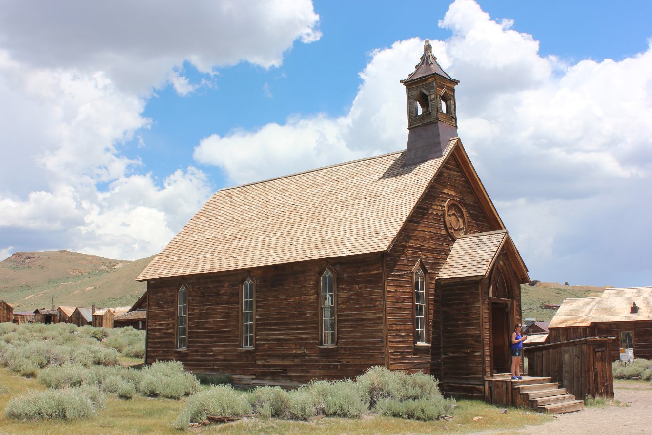
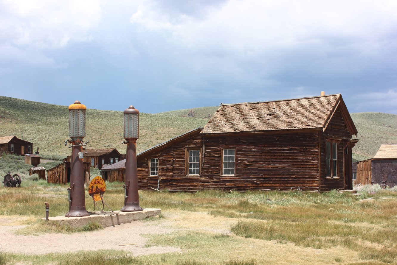
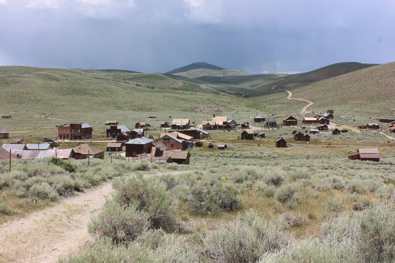
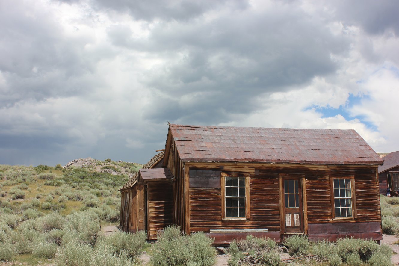
Hazards of Note:   The 3 miles of unpaved road can be nearly impassable to cars after inclement weather.  Summer afternoons can also bring significant thunder storms. Crowd Factor:   High.  This is a very popular state park due to the excellent condition of the buildings, which are kept in "arrested decay" so that they continue to appear in their natural rustic condition.   Expect to share the park with hundreds of others, but it will not diminish the exprerience.
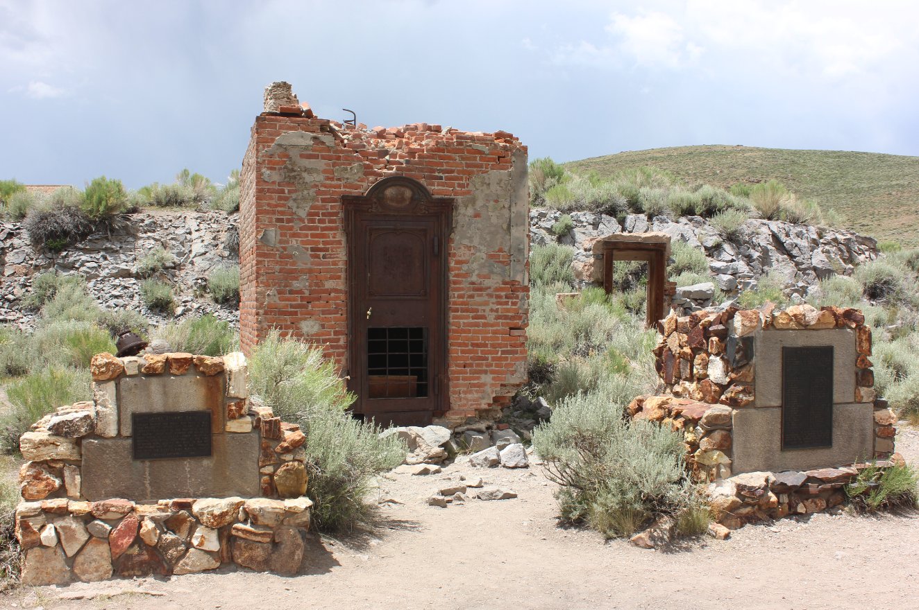
General Notes:
From the parking area, head toward the plaque at the east end of the parking area, and begin a walking tour of the old town.  The information pamphlet available at the State Park entrance is vital for full enjoyment of the town, as it has an explanation and history of most of the buildings in the area.  The primary route heads counter clock-wise through the bulk of the western end of the town, as much of the area furthest east is off-limits due to safety issues.  


Waiting at the entrance to the Bodie State Park after the 17 mile drive in from Highway 395, the last three miles of which are on unpaved dirt road. Entering the park
A look at the town from the access road on the way to the parking area.
Bodie from afar 
Information plaque near the parking area with a good summary of the history of the town and area. Bodie town info plaque
One of the first buildings on the tour is the old Methodist Church. Methodist Church 
Looking east toward some of the older buildings which are not accessible at this time. Looking east 
A little past the church is the area where an older style gas station was located, along the same street which once housed over 100 bars. The old gas station
A look at the old firehouse, which going by the printed tour guide will take you right past it later on during the loop trip through town.
Firehouse 
A look back at the old hotel and in town. Hotel 
The old schoolhouse a little further up the road from the hotel. School house 
Looking north toward that end of town, which was not visited this time around.
North of town
The old vault is pretty much all that remains of the old bank in town. Bank remains 
Finishing up the loop hike through town, heading south toward the Methodist Church and hotel at the cross street up ahead. Circling back
Would have liked to check out just a little bit more of the town on this day, but after about an hour the weather began to turn quickly, and within 15 minutes of getting back to the car the clouds opened up on those still walking around the town. Oncoming weather
GPS Track of the full hike. GPS Track of Hike