Back to index Duane Bliss and Genoa Peaks Hike
Trip Date:  10/17/2014

Distance
: 15.2 Miles

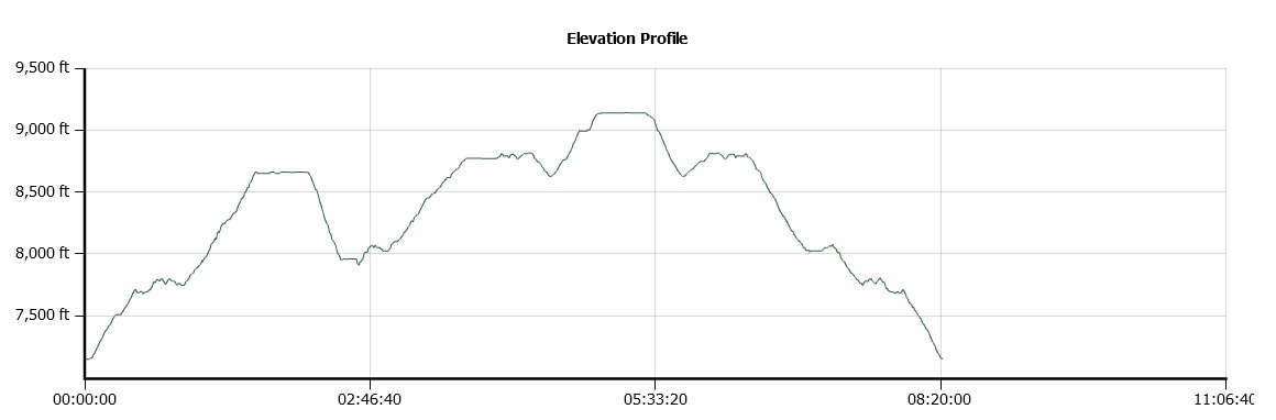
Vertical Gain: 2000'

Group Size: 6

Hike Rating:  Easy   Moderate    Hard    Strenuous
Snow Valley Peak Route
Download GPX GPX for this trip
Duane Bliss and Genoa Peaks Trail Elevation Profile
Start Coordinates:   N 39 06.219  W 119 53.744     End Coordinates:   Same as start coordinates
Car Shuttle Req'd:   No Parking Directions:   Take Highway 50 east from California to Spooner Summit.  Park on the south side of the highway at the parking area provided for the Tahoe Rim Trail hike.
Hazards of Note:   Very long trip with two significant elevation gains to the top of the two different peaks.  The first peak (Duane Bliss) is a cross-country trek up the steep side of a mountain.   Crowd Factor:   Moderate.  The Tahoe Rim Trail is very popular but this is a lesser-travelled section of it by the general public.
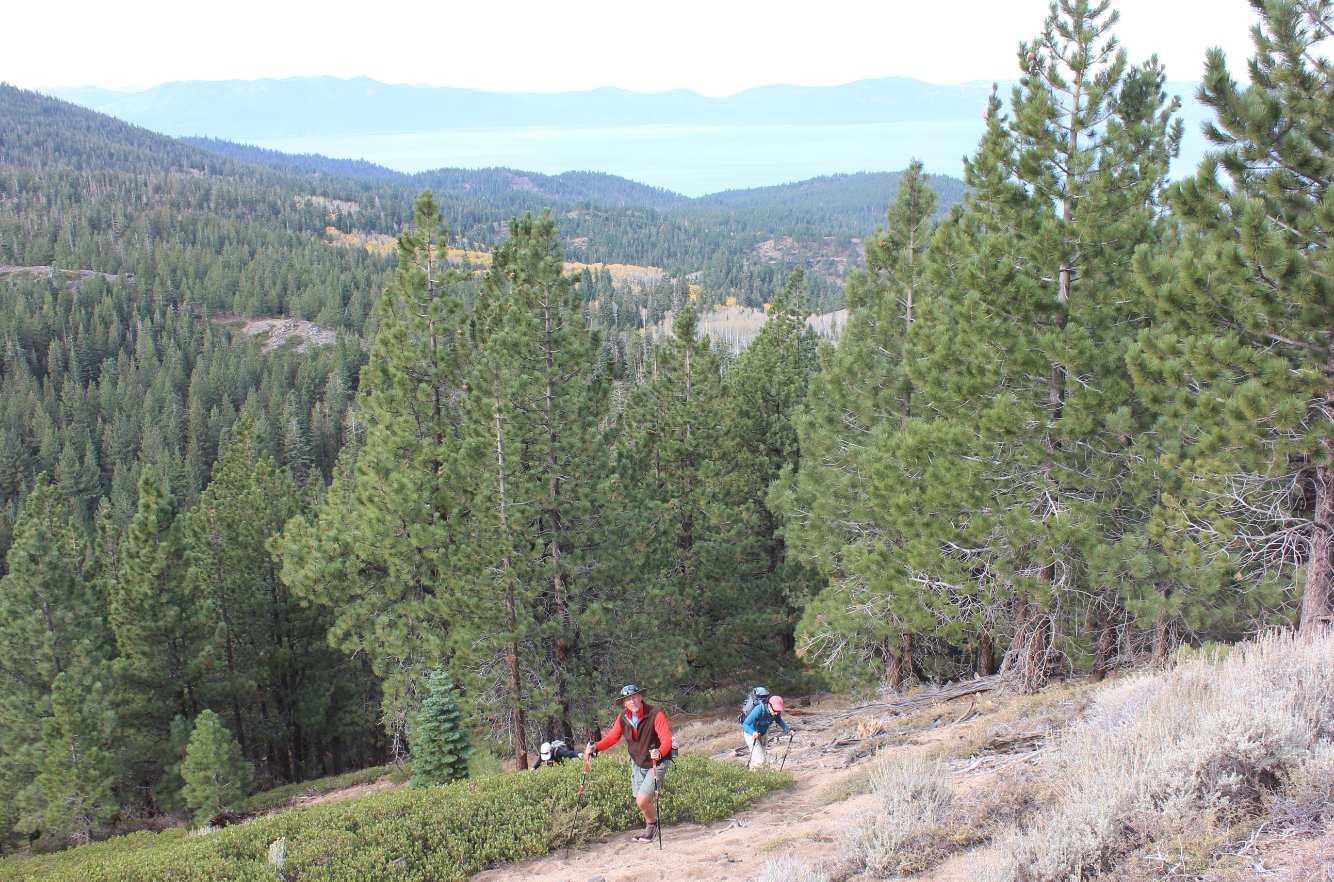
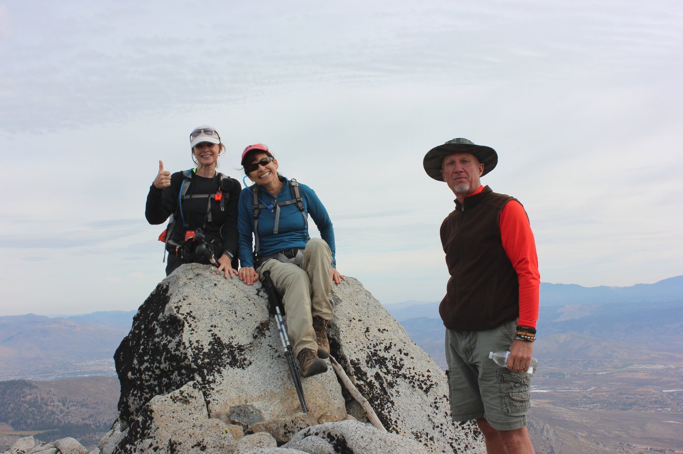
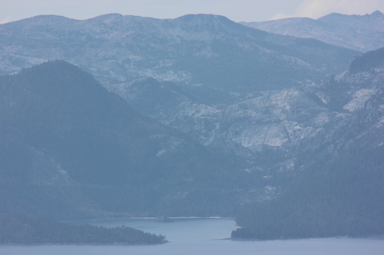
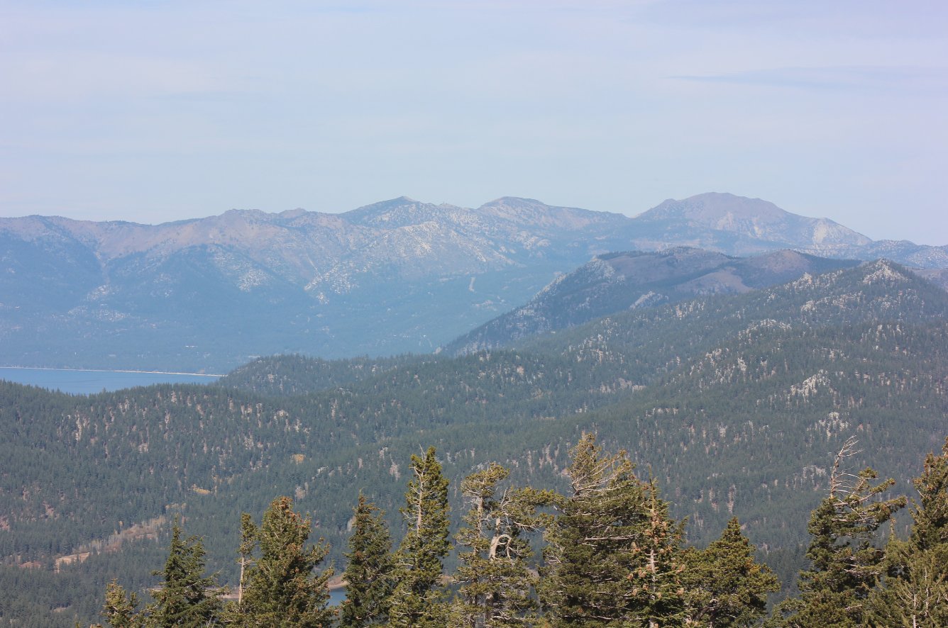
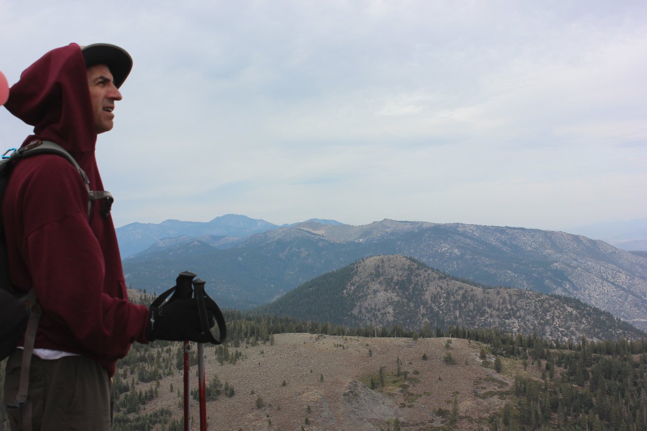
General Notes:
From the parking at Spooner Summit head south along the Tahoe Rim Trail (TRT.)  The first mile and a half is a very steady uphill, rising about 800 feet before levelling off just a little bit for a short way.  As you pass the base of Duane Bliss on the west side, there is an old road that is overgrown on the left, but easily identifiable that you head off to start the trek to the top of the peak.  The road disappears quickly, but there are use trails to the left that then begin the climb up to the top via a number of switchbacks and cross country trekking.  It is almost 1000 feet in elevation to get to the top, but the views are amazing in all directions and well worth the effort to get there.
After heading back down you will pick up the TRT again, and about a mile further you will come to a junction with a dirt road.  Continue straight on, heading toward the signed "Lake View" in 2 miles.  This viewpoint has great vistas of most of Lake Tahoe, and there is even a Kiwanis placed bench nearby that serves as a nice spot to rest.  From here, it is another couple miles to the top of Genoa Peak, which you will get to when you come to another old road off to the left, which you follow all the way to within about 200 feet of the summit.  From there, it is an easy scramble up the rocks to the top.


Historical information at the Spooner Summit south trailhead. At the Trailhead
Our group (minus myself) at the start of the hike.  Notice that this direction Tahoe City, a mere 10 mile away across the lake is 102 miles of trail distance. Our group at the start
After the initial mile and a half of climbing great vistas of Lake Tahoe are the reward all along the trail. Lake Tahoe
The sign you need to follow at the first four way junction along the trail. Making progress
It is quite a climb once you leave the TRT to get up to the top of Duane Bliss peak. Heading up
When you turn back to take in the views, however, the climb is well worth it. Views
Julia, one of our hiking crew, at the top of the peak with the dry Carson Valley of Nevada far below in the background. Julia at the top
Three of our crew at the very top, with Carson City far below. More peak baggers     
All of us celebrating the first bagged peak of the day with Lake Tahoe and Desolation Wilderness serving as a scenic background. Our group
A closeup view of Emerald Bay far across the lake and Fanette Island just visible near the far shore.  This spot is one of the main access points to Desolation Wilderness from both Bayview and Eagle Falls trailheads. Closeup of Emerald Bay
The view north toward Incline Village, Relay Peak and Mt. Rose off to the far right. Mt. Rose
First clear view of our final peak destination, Genoa Peak just under two miles away. Genoa Peak
Last little scramble up the rocks to Genoa Peak. Rocky scramble 
Phil enjoying the fruits of our labors to get to the top, with Duane Bliss the second ridge away from us. Phil at the top
Julia on a rockly outcropping near the peak and overlooking the deep Genoa valley below. Julia
Lots of viewpoints at the top of Genoa Peak, but also lots of equipment.  The shed made an excellent windbreak for us to enjoy lunch at the top before heading back to the TRT. Equipment views
Catching Fallen Leaf lake seeming to glow in the late afternoon sunlight on our way back down from Genoa Peak. Fallen Leaf Lake
Myself stopping to take in the views near the spot signed along the trail as Lake View. Myself
GPX image of the hike. GPS track of hike